
Hi Everybody!!
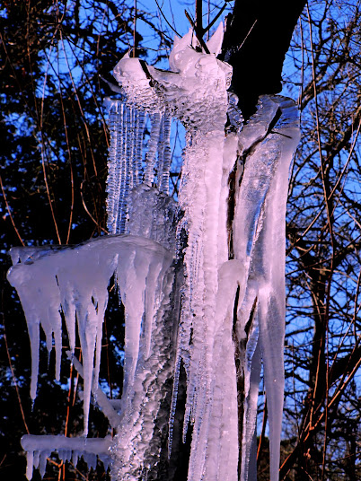
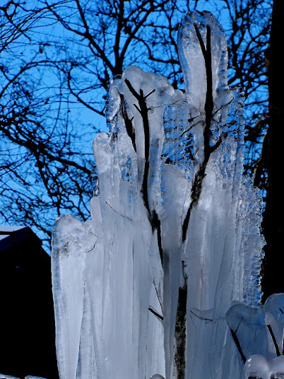
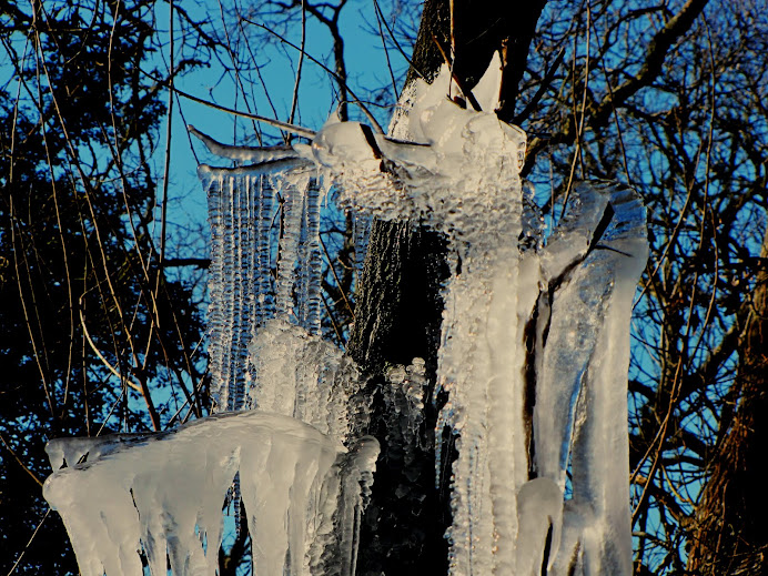
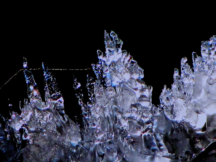
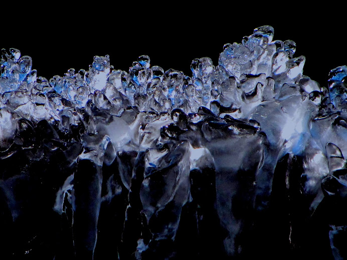
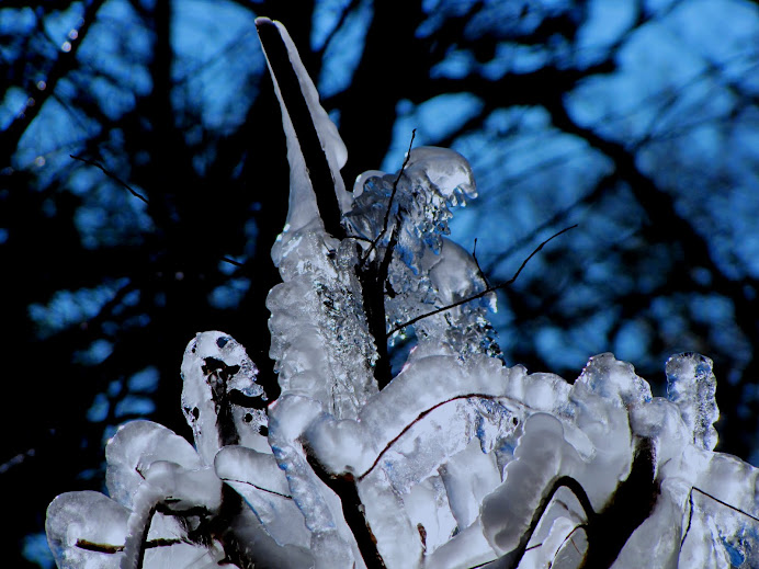
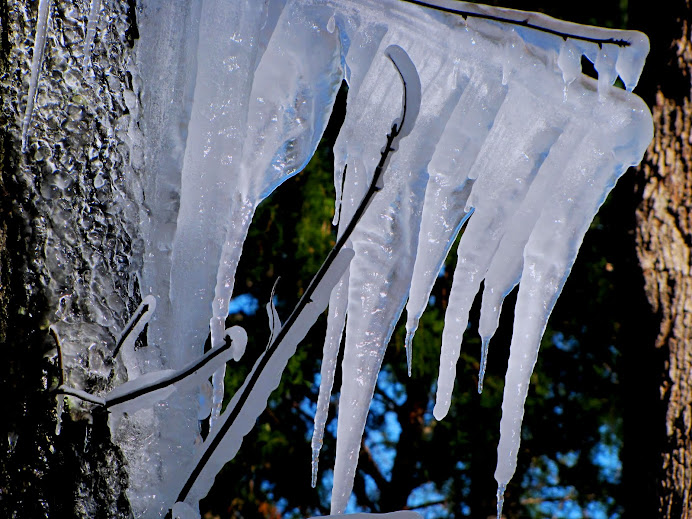
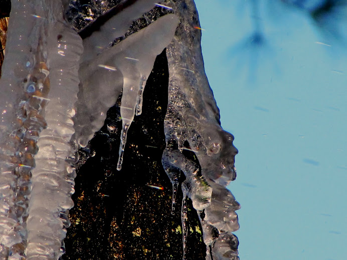
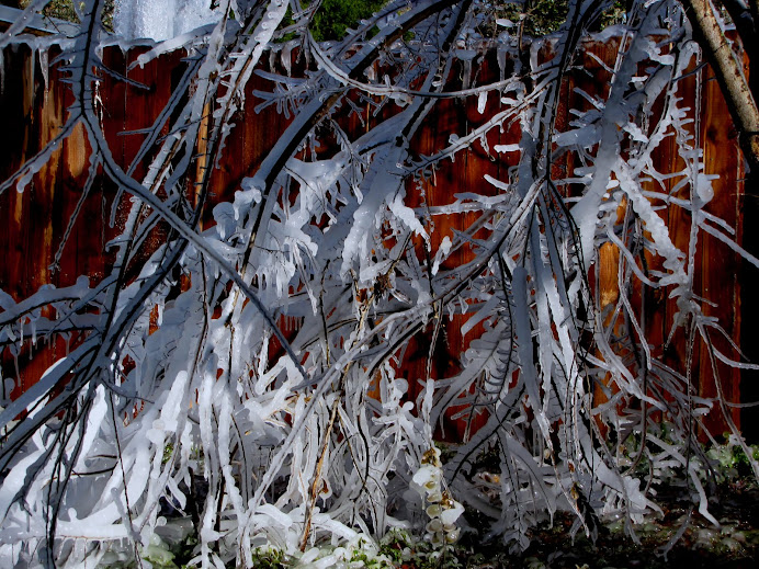
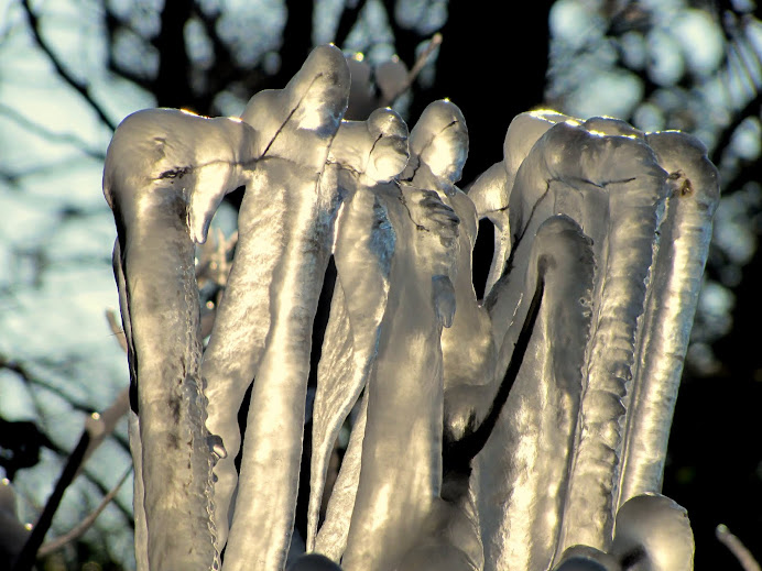
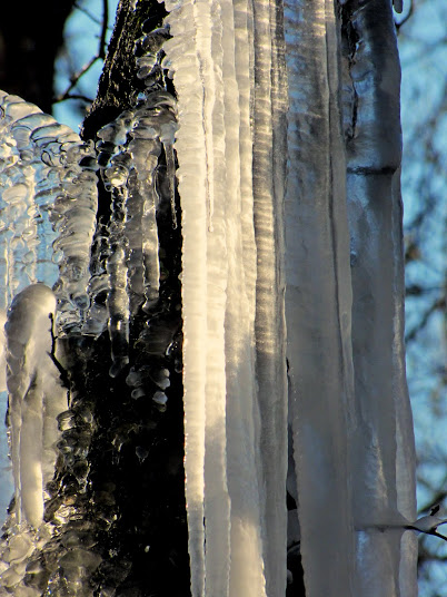
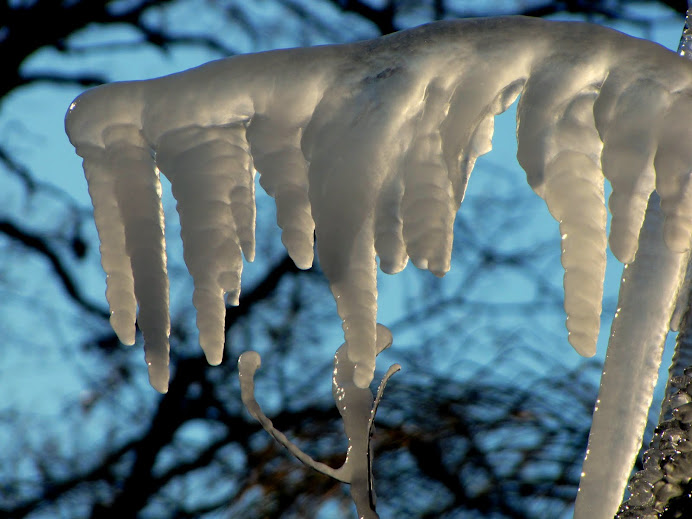
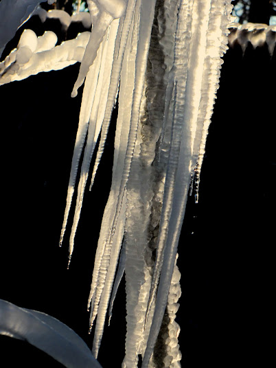
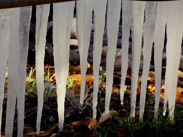
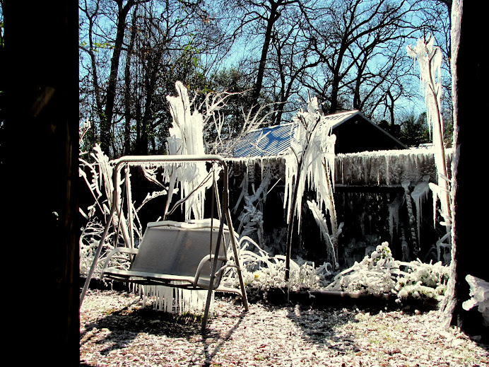
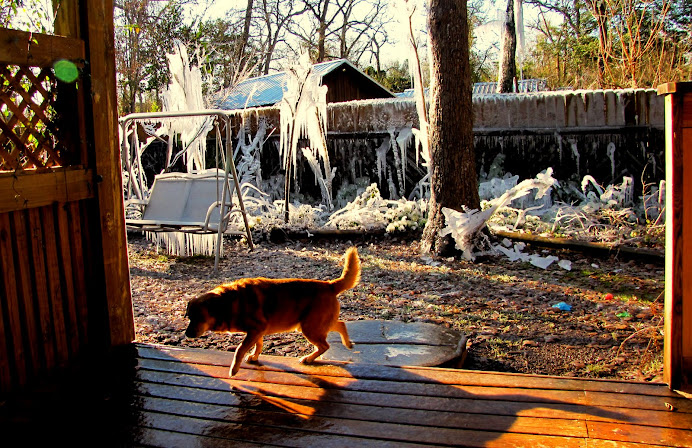
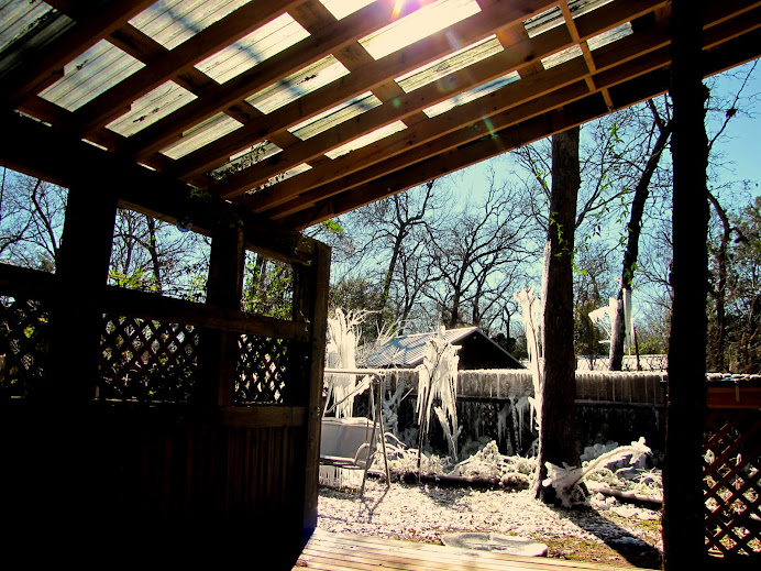
Icicles are something I never had in this part of South Texas. So one January day a couple of years ago when it was going to freeze overnight, I set up an impact sprinkler on the fence and let it run all night! The results were spectacular as you will see in this photostudy. I finally had ice to photograph! You will note there is no ice anywhere except where the sprinkler hit. This ice garden was so pretty, people drove down here to see it. (I can hear all of my northern friends laughing at the Texas lady who made an ice garden). Up north you have plenty of ice and snow. This was my first. So, celebrate my icicles with me. Below you will also find an update from Wikipedia on: The cold wave of 2014. Enjoy!

Icicle
From Wikipedia, the free encyclopedia

Formation and dynamics[edit]
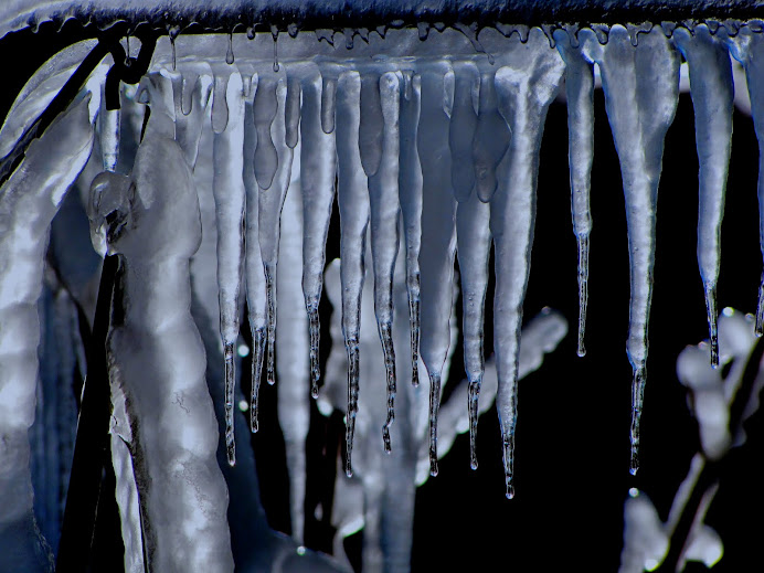
Typically, icicles will form when ice or snow is melted by either sunlight or some other heat source (such as heat leaking from the interior of a heated building), and the resulting melted water runs off into an area where the ambient temperature is below the freezing point of water (0 °C/32 °F), causing the water to refreeze. Over time continued water runoff will cause the icicle to grow.
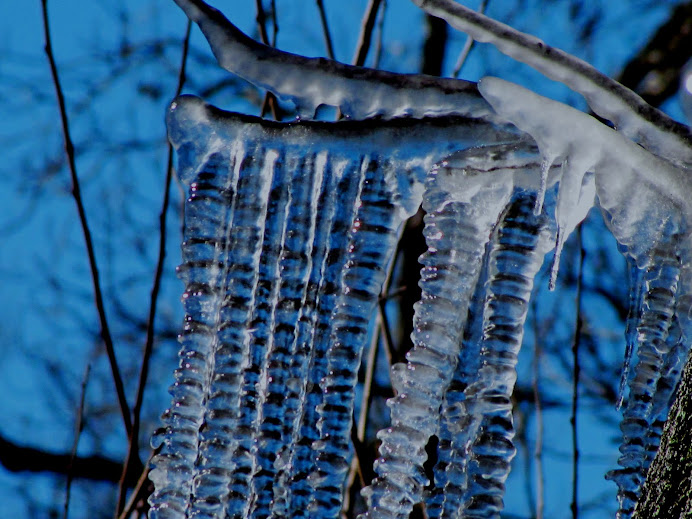
Richard Armstrong, a senior research scientist at the National Snow and Ice Data Center in Boulder, Colorado, has explained why icicles come in various shapes and sizes. Icicles form on surfaces which might have a smooth and straight, or irregular shape, which in turn influences the shape of an icicle. Another influence is melting water, which might flow toward the icicle in a straight line or which might flow from several directions.[1]
Given the right conditions, icicles may also form in caves (in which case they are also known as ice stalactites). They can also form around salty water sinking from sea ice. These so-called brinicles can actually kill sea urchins and starfish, which was observed byBBC film crews near Antarctica.[2][3][4]
Damage and injuries caused by icicles[edit]
Icicles can pose both safety and structural dangers.[5] Icicles that hang from an object may fall and cause injury and/or damage to whoever or whatever is below them. In addition, ice deposits can be heavy. If enough icicles form on an object, the weight of the ice can severely damage the structural integrity of the object and may cause the object to break.
The story of an English youth who was killed by a falling icicle in 1776 has been often recounted.[6][7][8][9]
Armstrong, the scientist from the National Snow and Ice Data Center, told a journalist, "Another twist is very large icicles falling from cliffs along highways hitting cars. Where I used to work doing avalanche hazard assessment and forecasting along U.S. Highway 550in southwestern Colorado, icicles have fallen and destroyed passing cars."[1]
In 2010, five people were killed and 150 injured by icicles in Saint Petersburg, Russia after a heavy snow that also caused apartment block roofs to collapse, as well as creating water damage to private homes and to the National Library of Russia.[10]
Kathleen F. Jones of the U.S. Army Cold Regions Research and Engineering Laboratory states, "The combination of the ice load and the wind on ice load can break wires, cross arms, and poles and/or other supporting structures. Damage associated with icicles on roofs may be to vehicles parked next to the overhang. Icicles on roofs are also often associated with ice dams that may cause water to infiltrate under the shingles with possible water damage to the house or building and its contents."[1]
Link to photostudy in G+ Album:
https://plus.google.com/photos/102505667655735408566/albums/5568248011660355729?banner=pwa

http://en.wikipedia.org/wiki/2014_North_American_cold_wave
2014 North American cold wave
From Wikipedia, the free encyclopedia
| 2014 North American cold wave | |
|---|---|

A GOES 13 satellite image of the severe winter weather on January 2
| |
| Formed | January 2, 2014 |
| Dissipated | Active |
| Lowest pressure | 939 hPa (27.7 inHg)[1] |
| Damage | $5 billion(United States)[2] |
| Fatalities | 21[3][4] |
| Areas affected | Canada United States Mexico United Kingdom |
Meteorology[edit]


Sudden stratospheric warming[edit]
The breakdown of the polar vortex and subsequent southward movement of tropospheric Arctic air was caused by sudden stratospheric warming (SSW),[12] a phenomenon discovered in 1952. NASA states, "A major midwinter SSW event occurs when polar stratospheric temperatures increase by at least 25 K in one week, and the zonal-mean zonal wind at or near 10 hPa (at about 30km altitude) reverses direction and becomes easterly north of 60° N. Research has led to a good documentation of the frequency and seasonality of sudden warmings: just over half of the winters since 1960 have experienced a major warming event in January or February".[13] According to Charlton and Polvani[14] SSW in the Arctic has occurred during 60% of the winters since 1948 and 48% of these SSW events have led to the splitting of the polar vortex, leading to the same type of Arctic cold front that happened in January 2014.
A 2001 study found that "there is no apparent trend toward fewer extreme cold events on either continent over the 1948–99 period, although a long station history suggests that such events may have been more frequent in the United States during the late 1800s and early 1900s."[14] In fact, a 2009 MIT study found that such events are increasing and may be caused by the rapid loss of the Arctic ice pack.[15]
Jet stream[edit]
An initial contrast formed between cold air in Canada and mild winter temperatures in the United States.[7] The pressure difference caused significant winds where the air masses met, strengthening the jet stream. Winds led to bitter wind chills, worsening the impact of the record cold temperatures.[7] The New Scientist magazine reports the weak jet stream as being the cause rather than a polar vortex, as there is an altitude difference.[16]
Record cold temperatures[edit]
Locations throughout the U.S. and Canada experienced record cold temperatures.[17]
Related extreme weather[edit]


Heavy snowfall or rainfall occurred on the leading edge of the weather pattern. Strong winds prevailed throughout the freeze, making the temperature feel even colder than it actually was. In addition to rainfall, snowfall, ice, and blizzard warnings, some places along the Great Lakes were also under wind warnings.[34]
United States[edit]
In the U.S., the front pushed through and the second winter storm, named "Ion" by the Weather Channel, crossed the Great Lakes on January 5. A severe Arctic air outbreak sent temperatures in New York City plummeting to a record low of 4 °F (−16 °C) on January 7, which broke a 116-year record, days after unseasonably warm temperatures.[35] Freezing rain caused a Delta Air Lines flight to skid off a taxiway and into a snowbank at John F. Kennedy International Airport, with no injuries.[36] The storms associated with the Arctic front caused numerous road closures and flight delays and cancellations.
Southeastern Michigan received 5 to 18 inches (13 to 46 cm) of snow.[37] Hell, Michiganrecorded temperatures of 1 °F (−17 °C), prompting jokes about hell freezing over.[38]
Snowfall was lighter farther south, with between 0.5 and 2 inches (1.3 and 5.1 cm) of snow falling in Tennessee.[39]
Due in part to the southern extent of the cold wave, on January 7, locations in all 50 states recorded a temperature below freezing.[40]
Impact[edit]
The extreme cold weather grounded thousands of flights and seriously affected other forms of transport. Many power companies in the affected areas asked their customers to conserve electricity.
United States[edit]
Between 13 and 16 deaths have been attributed to the cold wave, with dangerous roadway conditions and extreme cold being cited as causes.[19][45][46]
At least 3,600 flights were cancelled on January 6, and several thousand were cancelled over the preceding weekend.[7] Further delays were caused by the weather at airports which did not possess de-icing equipment.[47] At O'Hare International Airport in Chicago, the jet fuel and deicing fluids froze.[11]
Amtrak cancelled scheduled passenger rail service having connections through Chicago, due to heavy snows or extreme cold.[48]Three Amtrak trains were stranded overnight on January 6, 80 miles (130 km) west of Chicago, near Mendota, Illinois, due to ice and snowdrifts on the tracks. The 500 passengers were loaded onto buses the next morning for the rest of the trip to Chicago.[49][50]Another Amtrak train was stuck near Kalamazoo, Michigan for 8 hours, while en route from Detroit to Chicago.[49] Chicago Metracommuter trains reported numerous accidents.[11] Detroit shut down its People Mover due to the low temperatures on January 7.[51]

Between January 5 and 6, temperatures fell 50 °F (28 °C) in Middle Tennessee, dropping to a high of 9 °F (−13 °C) on Monday, January 6 in Nashville. During the cold wave, the strain on the power supply had left 1,200 customers in Nashville without power, along with around 7,500 customers in Blount County.[39][52] The Tennessee Emergency Management Agency declared a state of emergency.[39]
Canada[edit]
A power failure in Newfoundland, late on January 5, left 190,000 customers without electricity. Most of the outages were restored by the following day.[54]
Air transportation was delayed out of airports in Montreal and Ottawa, as well as completely cancelled at Toronto Pearson International Airport, due to concerns about de-icing.[55][56] ExpressJet, a partner of United Airlines, cancelled its flights into and out of Winnipeg, stating that the combination of extreme low temperatures and ice crystals exceeded safe operating guidelines for their airplanes. However, other airlines continued flights into and out of Winnipeg, using the same kind of equipment.[57]
Ecological[edit]
The severe cold causes high mortality among the emerald ash borer. The progressive loss of ash trees in North America due to this insect has probably been delayed by this deep freeze.[58]
Possible role of anthropogenic climate change[edit]
| An editor has expressed a concern that this section lends undue weight to certain ideas relative to the article as a whole. Please help to discuss and resolve the dispute before removing this message. (January 2014) |
Research on a possible connection between individual extreme weather events and long-term climate change is new and the topic of scientific debate.[67] Prior to the events of January 2014, several studies on the connection between extreme weather and the polar vortex were published suggesting a link between climate change and increasingly extreme temperatures experienced by mid-latitudes (e.g., central North America).[68] This phenomenon can be understood to result from the rapid melting of polar sea ice, which replaces white, reflective ice with dark, absorbent open water (i.e., the albedo of this region has decreased). As a result, the region has heated up faster than other parts of the globe. With the lack of a sufficient temperature difference between Arctic and southern regions to drive jet stream winds, the jet stream may have become weaker and more variable in its course, allowing cold air usually confined to the poles to reach further into the mid latitudes.[69][70][71][72]
This jet stream instability brings warm air north as well as cold air south. The patch of unusual cold over the eastern United States was matched by anomalies of mild winter temperatures across Greenland and much of the Arctic north of Canada,[73] and unusually warm conditions in Alaska.[74] A stationary high pressure ridge over the North Pacific Ocean kept California unusually warm and dry for the time of year, worsening ongoing drought conditions there.[75]
...this is brendasue signing off from Rainbow Creek. See you next time!
my icicle maker, the sprinkler:
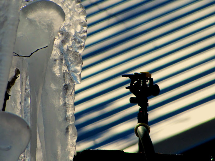
O+O
No comments:
Post a Comment
Hi Everybody! Please say hello and follow so I know you are here! Due to the inconsideration of people trying to put commercials on my blog comment area, I have restricted use of anonymous posts. Sorry that some hurt all.
My public email is katescabin@gmail.com No spammers or trolls