Welcome All People!
I am brendasue of Kates Cabin Bird Sanctuary in Texas. I invite you to come in for a Break where Human Nature Meets Mother Earth Nature and Father Space Nature!! I share my digital images from the Private Bird Sanctuary. In addition we have Field Trips and visit places on the computer in a Fantastic World Tour. It is my intention to inspire You to think about all Life on Earth for the Future of Humanity. It is my Hope that You will discover New Joy!
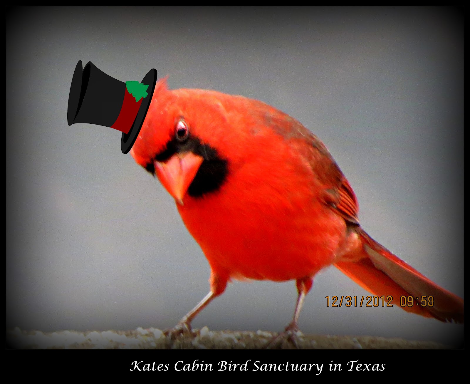
Hi Everybody!! Welcome to our Special New Year's Eve Celebration. As this year draws to a close, one of the things we can be thankful for is: We never, ever, ever will hear another word about December 21, 2012! Glad You all made it into the New Age of Enlightenment. It feels great! Welcome Aboard, it is likely to be a turbulent flight. Let's hang on to each other! My bags are still packed and ready to go! The van is now ready (I hope). I am rolling down the highway to the Texas Hill Country. I am happier than ever before to have the choice to go get in the van and hit the road just to see what I can see! I will check in- Enjoy the party! Make some changes in the New Year! Love You-
Feature Presentation: New Year's Eve Special Celebration for Us- Love Ya!
....this is brendasue signing off from Rainbow Creek! Mission Accomplished- Class Dismissed! Sing Along With Me: (LOUD)!!!!!!!!!!! http://www.youtube.com/watch?v=fzDft0DZRUw
Hi Everybody!! Welcome to the Nature Class where we will be exploring the most Unnatural Nature on the Planet. I am talking about WEATHER MANIPULATION. I feel I have lost credibility with my children, my Reverend Forde and some of You over this "Hot Topic" because I have indicated my opinion that somebody is creating the weather (i.e. hurricane Sandy and other storms). I did not work this hard writing over 300 posts this year to get to the last day of the last week of the last month of 2012 to be thought of as a liar. I am standing up for the Truth. I am standing up for Google You Tube and their excellent Library. I am standing up for my internet friends I do not know, who are trying to connect and make a difference for the sake of humanity. Now, I will be the first to agree that I am a registered ding-bat; but not a liar. Tonight, I have done what any self respecting Granny would do: Brought You more PROOF that I am correct!!!!!! For all my other nature lovers out there, thanks for coming to the Blog. Thanks for the +1 kisses, comments and emails. So for You, I have a fantastic post of video lineups that are going to blow You away. Try to watch them all to get the full effect of what I am feeling! To my friends who like clues and puzzle pieces, wowie zowie have I got something to add to the worktable tonight. You have to find them in the links and the clues. OMG-this goes on an on......... We are sneaking away to a semi-tropical Island tonight. I feel they tried to create an earthquake here on Christmas to recover minerals from the crust of the earth. It is closer than asteroids. The Island is owned by England. Now why would the old dying Goat want to unzip the gates of Hell?? I hope somebody figures this all out and does a vid to explain my scattered pieces here!
RAF Ascension
Wideawake Airbase/Field
FEATURE PRESENTATION: Excellent Video Reports and Documentation by Rev Michelle Hopkins
'HAARP' MASSIVE TTA's DISCOVERED on SECRET ISLAND and SEA FLOOR Causing 2 EARTHQUAKES ???
'Like' if you like. Feel free to subscribe to my channel. 'HAARP' MASSIVE TTA's DISCOVERED on SECRET ISLAND and SEA FLOOR Causing 2 EARTHQUAKES ??? Incident lasted 2 days: December 24th and December 25th, 2012. TTA = Tesla Tech Array HTA = HAARP Type Array
'Like' if you like. Feel free to subscribe to my channel. I was asked to do this video, because of the unnatural weather assault on our west coast. So here it is... I enlarge and stop motion after initially showing the mapping loop feed so that it is much easier to see the sonic manipulation.
'HAARP' TTA's DISCOVERED Engineering TYPHOON BOPHA??? GENOCIDE !!! CAUGHT on Satellite and Radar...
'Like' if you like. Feel free to subscribe to my channel. TTA = Tesla Tech Array like HAARP or Arecibo I have been asked to share information that I have discovered regarding the Phillipines and Typhoon Bopha. And now the powers that be are turning typhoon Bopha back toward the Philippines??? Interestingly, Typhoon Bopha took out the Philippines Army military base, leaving the populous extremely vulnerable.
From deep on the ocean floor at the mid-Atlantic ridge, huge undersea volcanoes rise up from the deep, with their own unique eco-systems and communities of undersea life on each of them, feeding on the marine snow
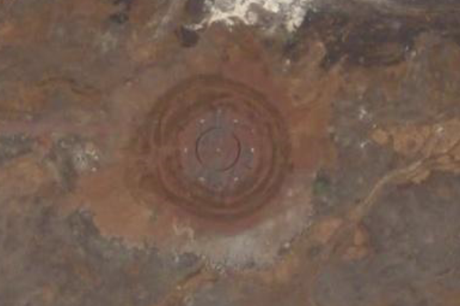
Possible Undersea Bases Earthquakes 1 - 5.2EQ in Northern Mid Atlantic Ridge - 10KM Range
Locations of obvious anomalous alterations found on Google Earth which might be Undersea Bases or Structures perhaps. Bare in mind the study that was released by two people affiliated by the Stansford Research Institute [T.G. Warfield & L.R. Parkinson] in 1968 named "Feasibility of Manned In-Bottom Bases" that is covered by Richard Sauder Ph.D. in his book "Hidden in Plain Sight" in which he discusses the study, which points out that the approximate cost of constructing 30 Undersea Bases [In-bottom & On-Bottom] was to be about $2.7 Billion Dollars With that in mind, I have found what could be a pattern of quakes that are taking place in the 10 Kilometer range in some of these structures or anomalies. This is highly suspect, especially since David Wilcock has stated that his insider contacts into the Black Covert World have stated that some of these facilities have been vacated or destroyed. This depth number of 10 Kilometers will be quite common with respects to these possible facilities and I will try and keep tracking it in order to see if anything 'develops' from these. The coordinates for this 5.2M and 10 Kilometer range earthquake are: 19°48'8.09"N 45°43'47.31"W
Ascension Island is an isolated volcanic island in the equatorial waters of the South Atlantic Ocean, around 1,600 kilometres (1,000 mi) from the coast of Africa and 2,250 kilometres (1,400 mi) from the coast of South America, which is roughly midway between the horn of South America and Africa. It is governed as part of the British Overseas Territory of Saint Helena, Ascension and Tristan da Cunha,[1] of which the main island, Saint Helena, is around 1,300 kilometres (800 mi) to the southeast. The territory also includes the "remotest populated archipelago" on earth, the sparsely populated Tristan da Cunhaarchipelago, some thirty degrees farther south and about half the way to the Antarctic Circle.
The island is named after the day of its recorded discovery, Ascension Day, and is located at 7°56′S14°22′W
7°56′S14°22′W, about as far south of the equator as tropical Venezuela is to its north. Historically, it has played a role as an important safe haven and coaling station to mariners and for commercial airliners during the days of international air travel by flying boats and during World War II was an important naval and air station, especially providing antisubmarine warfare bases in the Battle of the Atlantic and throughout the war.[2] Ascension Island was garrisoned by the British Admiralty from 22 October 1815 to 1922.
During World War II, to supply and augment extensive amphibious aircraft antisubmarine patrol operations ongoing from the early days of the war, the United States built an airbase on Ascension Island, known as "Wideawake",[3] after a nearby colony of Sooty Terns(locally called 'Wideawake' birds because of their loud, distinctive call, which would wake people early in the morning). The airbase, which was under construction by the 38th Combat Engineer Battalion of the Army Corps of Engineers, was unexpectedly visited by two British Fairey Swordfish torpedo planes on 15 June 1942. According to one of the pilots, Peter Jinks, the planes were fired upon before being recognised as allies. The Swordfish had to land on the unfinished airstrip, thus becoming the first land-based aircraft to land on Ascension Island proper — which had long served as an ASW base for Catalina (PBY Catalina) flying boats. The event was later commemorated with a postage stamp 15 June 1982.
The airfield was used by the US military as a stopping point for American aircraft crossing the Atlantic Ocean on the way to theatres of operation in Europe and Africa. American bombers based at Wideawake were engaged in the Laconia incident. After the end of World War II, and American departure, the airbase fell into disuse.
The island viewed from atop Green Mountain, looking south towards Two Boats Village and Georgetown
The only local military action during World War II occurred on 9 December 1941. At around mid-day, the U-boatU-124 approached Georgetown on the surface with the intention of sinking any ships at anchor or shelling the cable station. A two-gun shore battery at Cross Hill, above Georgetown, fired on the submarine. The guns scored no hits but the U-boat submerged and retreated. The battery remains largely intact to this day, together with its guns, BL 5.5 inch Mark I naval guns removed from HMS Hood during a refit in Malta in 1938.
With the Space Race and the Cold War, the Americans returned in 1956.[3] Wideawake Airfield expanded in the mid 1960s. The runway, with its strange hump, was extended, widened, and improved to allow its use by large aircraft, and later to act as an emergency runway for the Space Shuttle, although the Shuttle never had occasion to use it.[3] TheUnited States Air Force uses the island as part of its Eastern Range. NASA established a tracking station on the island in 1967, which it operated for more than 20 years before closing it down in 1990.[3] The island retains a role in space exploration: the European Space Agency now operates an Ariane monitoring facility there.[3] The BBC Atlantic Relay Station was installed in 1966 for short-wave broadcasts to Africa and South America.
Demographics
Georgetown seen here is the primary settlement on the island and comprises the post office, police station, court, government house and the island's supermarket. It also boasts the island's port: a small pier where supplies are off-loaded and a connection exists for a pipeline hose for fuel.
There is no indigenous or permanent population on the island, although around 880 people live there as of 2010: 696 from Saint Helena nicknamed the "Saints"[23] (who are British citizens), 106 British citizens from Great Britain, 70 US citizens and 12 of other nationalities.[24]RAF Ascension Island is made up of 17 staff.
There are five settlements:
Georgetown (the main civilian settlement and capital of the island)
Additionally, there are some cottages on Green Mountain, occasionally occupied by visitors, and the Residency, the official residence of the Administrator.
In order to enter Ascension Island, people need the written permission of the Administrator. There is no permanent residence. A contract of employment is a requirement to stay on the island,[23] though short term visits by tourists are possible with prior approval. The British government has asserted that there is no "right of abode" on Ascension Island.[25] As the local newspaper The Islander reported at the time,[26][27] it is an issue that was disputed by some former Council members and some of the long-time expatriate employees.
....this is brendasue signing off from Rainbow Creek. See You next Year! Love to Everybody. Put Your brains in motion to become part of the solution instead of part of the problem. We simply must stop anybody trying to blow up the Earth. Of Course, one more great performance (this is his road trip in the truck)
English: Wideawake Airfield on Ascension Island with an plane from Air Seychelles (on contract to the UK Ministry of Defence) to maintain the airlink between RAF Brize Norton in Oxfordshire and RAF Mount Pleasant in the Falkland Islands. Left of the centre is Green Mountain, the island's highest summit.
to share – to copy, distribute and transmit the work
to remix – to adapt the work
Under the following conditions:
attribution – You must attribute the work in the manner specified by the author or licensor (but not in any way that suggests that they endorse you or your use of the work).
share alike – If you alter, transform, or build upon this work, you may distribute the resulting work only under the same or similar license to this one.


 HAPPY NEW YEAR 0001
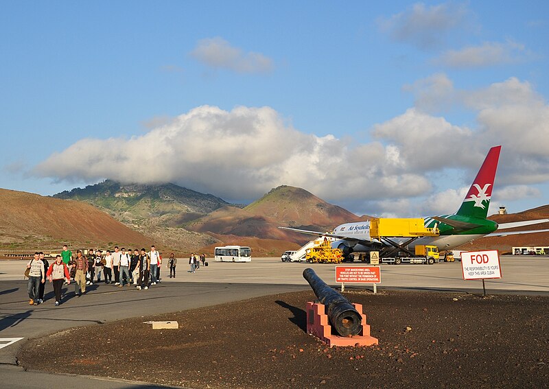


.jpg)


.jpg)

.JPG)
.JPG&action=edit§ion=1)
.JPG¶ms=-7.9678527777778_N_-14.405019444444_E_type:camera_region:SH_heading:E&language=en)
.JPG&action=edit§ion=2)