

I saw some interesting light glowing through the trees, so I thought we would walk down to the clearing to see what kind of cloud we have in the sky tonight! Dad told me most of my life to get my head out of the clouds, but it appears that never happened!
Look at this cloud! It is Fantastic!
There is my street sign (Tyrone Street). This is the closest place to get a view of this cloud.
Come on in and get comfortable. We will have a Cloudy Blog Photostudy Tonight!
To begin your journey, just push play
Cumulonimbus cloud
From Wikipedia, the free encyclopedia
| Cumulonimbus cloud | |
|---|---|
 Cumulonimbus capillatus incus | |
| Abbreviation | Cb |
| Symbol | |
| Genus | Cumulonimbus (heap, cloud/severe rain) |
| Altitude | 2,000–16,000 m (6,500–60,000 ft) |
| Classification | Family D (Vertically developed) |
| Appearance | Very tall and large clouds |
| Precipitation cloud? | Yes, often intense, but may be virga (virga—occasionally a streak of precipitation but evaporates before it hits the ground) |
Appearance

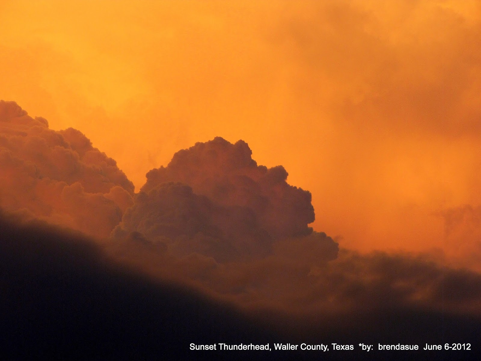
The anvil is the flat layer at the top. The downdraft is the rainy area to the right. Cumulonimbus clouds usually form from cumulus coop at a much lower height, thus making them, like cumulus clouds, grow vertically instead of horizontally, thus giving the cumulonimbus its mushroom shape. The base of a cumulonimbus can be several miles across, and it can be tall enough to occupy middle as well as lowaltitudes; though formed at an altitude of about 500 to 13,000 feet (150 to 3,960 metres), its peak can reach up to 75,000 feet (23,000 metres)[1] in extreme cases. Typically, it peaks at a much lower height, usually up to 20,000 feet (6,090 meters).[verification needed] Well-developed cumulonimbus clouds are also characterized by a flat, anvil-like top (anvil dome), caused by straight line winds at the higher altitudes which shear off the top of the cloud, as well as by an inversion over the thunderstorm caused by rising temperatures at the equilibrium level near the tropopause. This anvil shape can precede the main cloud structure (vertical updraft towers) for many miles, causing anvil lightning. Sometimes rising air parcels surpass the equilibrium level due to momentum and form an overshooting top culminating at the maximum parcel level. This is the largest of clouds usually extending through all three cloud regions when vertically developed. All other clouds are dwarfed even compared to small cumulonimbus clouds.
Effects
See also: Severe weather and Thunderstorm
Cumulonimbus storm cells can produce heavy rain of a convective nature and flash flooding, as well as straight-line winds. Most storm cells die after about 20 minutes, when the precipitation causes more downdraft than updraft, causing the energy to dissipate. If there is enough solar energy in the atmosphere, however (on a hot summer's day, for example), the moisture from one storm cell can evaporaterapidly—resulting in a new cell forming just a few miles from the former one. This can cause thunderstorms to last for several hours. This multicell cloud structure exists until a cold downdraft preceding the cumulonimbus at ground level flows before the cloud at a distance sufficient to disrupt updraft (5–10 kilometers). From this moment on the cumulonimbus cloud quickly degrades and dissipates, breaking into cumulus congestus, meaning a little rain may still fall and the cirrus spissatus anvil cloud. Eventually all that remains is some broken stratocumulus and altostratus and some strands of cirrus.
Cumulonimbus clouds sometimes form mammatus clouds.
Cumulonimbus clouds contain severe convection currents, with very high, unpredictable winds, particularly in the vertical plane (updrafts and downdrafts). They are therefore extremely dangerous to aircraft. Smaller, propeller-driven planes cannot cope with the conditions and must fly around them; larger jet aircraft fly over the smaller ones and around larger examples. Larger planes are also equipped with weather radar and wind shear detectors to help guide them through, in the event that they need to pass through such clouds to land. Snow and ice conditions can develop in the colder upper portions of the clouds, even when the air temperatures at ground level are moderate.
The air convection can also form mesocyclones, which can cause hail and tornadoes.
[edit]Cloud types
Main article: List of cloud types
Clouds form when the dewpoint of water is reached in the presence of condensation nuclei in the troposphere. The atmosphere is a dynamic system, and the local conditions of turbulence, uplift and other parameters give rise to many types of clouds. Various types of clouds occur frequently enough to have been categorized. Furthermore, some atmospheric processes can make the clouds organize in distinct patterns such as "wave clouds" or "actinoform clouds", these are large-scale structures and not always readily identifiable from single point of view.
Photostudy of our Cumulonimbus cloud


This concludes the photostudy. Enjoy the Vids!
Just Push Play
Just Push Play
Just Push Play
Just Push Play
..this is brendasue signing off from Rainbow Creek.
See You next time. Goodnight.
Just Push Play
Just Push Play
Of course, one more great Performance!
Just Push Play
O+O
No comments:
Post a Comment
Hi Everybody! Please say hello and follow so I know you are here! Due to the inconsideration of people trying to put commercials on my blog comment area, I have restricted use of anonymous posts. Sorry that some hurt all.
My public email is katescabin@gmail.com No spammers or trolls