

I am still looking for Rain. It has been all around me, but not here! My friend 10 minutes away got an inch and half in 30 minute Gully-washer while I get a few minutes of light rain. Somebody send out a call for 'Rain Seeds' as Rainbow Creek has dried up now and the baby fish are gone. Your photostudy tonight is the few minutes of rain we did receive and I take You with me on a trip to town down the Country Road. We will find the beautiful rain clouds that elude me! Enjoy!


https://en.wikipedia.org/wiki/Rain
Rain
From Wikipedia, the free encyclopedia

Rain is liquid water in the form of droplets that have condensed fromatmospheric water vapor and then precipitated—that is, become heavy enough to fall under gravity. Rain is a major component of the water cycle and is responsible for depositing most of the fresh water on the Earth. It provides suitable conditions for many types of ecosystem, as well as water for hydroelectric power plants and crop irrigation.
The major cause of rain production is moisture moving along three-dimensional zones of temperature and moisture contrasts known asweather fronts. If enough moisture and upward motion is present, precipitation falls from convective clouds (those with strong upward vertical motion) such as cumulonimbus (thunder clouds) which can organize into narrow rainbands. In mountainous areas, heavy precipitation is possible where upslope flow is maximized withinwindward sides of the terrain at elevation which forces moist air to condense and fall out as rainfall along the sides of mountains. On the leeward side of mountains, desert climates can exist due to the dry air caused by downslope flow which causes heating and drying of the air mass. The movement of the monsoon trough, or intertropical convergence zone, brings rainy seasons to savannah climes.
The urban heat island effect leads to increased rainfall, both in amounts and intensity, downwind of cities. Global warming is also causing changes in the precipitation pattern globally, including wetter conditions across eastern North America and drier conditions in the tropics.[citation needed] Antarctica is the driest continent. The globally averaged annual precipitation over land is 715 millimetres (28.1 in), but over the whole Earth it is much higher at 990 millimetres (39 in).[1]Climate classification systems such as the Köppen climate classification system use average annual rainfall to help differentiate between differing climate regimes. Rainfall is measured using rain gauges. Rainfall amounts can be estimated by weather radar.
Rain is also known or suspected on other planets, where it may be composed of methane, neon, sulfuric acid or even iron rather than water.
Formation
Water-saturated air
Air contains water vapor and the amount of water in a given mass of dry air, known as the mixing ratio, is measured in grams of water per kilogram of dry air (g/kg).[2][3] The amount of moisture in air is also commonly reported as relative humidity; which is the percentage of the total water vapor air can hold at a particular air temperature.[4] How much water vapor a parcel of air can contain before it becomes saturated (100% relative humidity) and forms into a cloud (a group of visible and tiny water and ice particles suspended above the Earth's surface)[5] depends on its temperature. Warmer air can contain more water vapor than cooler air before becoming saturated. Therefore, one way to saturate a parcel of air is to cool it. The dew point is the temperature to which a parcel must be cooled in order to become saturated.[6]
There are four main mechanisms for cooling the air to its dew point: adiabatic cooling, conductive cooling, radiational cooling, and evaporative cooling. Adiabatic cooling occurs when air rises and expands.[7] The air can rise due to convection, large-scale atmospheric motions, or a physical barrier such as a mountain (orographic lift). Conductive cooling occurs when the air comes into contact with a colder surface,[8] usually by being blown from one surface to another, for example from a liquid water surface to colder land. Radiational cooling occurs due to the emission of infrared radiation, either by the air or by the surface underneath.[9]Evaporative cooling occurs when moisture is added to the air through evaporation, which forces the air temperature to cool to itswet-bulb temperature, or until it reaches saturation.[10]
The main ways water vapor is added to the air are: wind convergence into areas of upward motion,[11] precipitation or virga falling from above,[12] daytime heating evaporating water from the surface of oceans, water bodies or wet land,[13] transpiration from plants,[14] cool or dry air moving over warmer water,[15] and lifting air over mountains.[16] Water vapor normally begins to condense on condensation nuclei such as dust, ice, and salt in order to form clouds. Elevated portions of weather fronts (which are three-dimensional in nature)[17] force broad areas of upward motion within the Earth's atmosphere which form clouds decks such asaltostratus or cirrostratus.[18] Stratus is a stable cloud deck which tends to form when a cool, stable air mass is trapped underneath a warm air mass. It can also form due to the lifting of advection fog during breezy conditions.[19]
Coalescence

Coalescence occurs when water droplets fuse to create larger water droplets. Air resistance typically causes the water droplets in a cloud to remain stationary. When air turbulence occurs, water droplets collide, producing larger droplets. As these larger water droplets descend, coalescence continues, so that drops become heavy enough to overcome air resistance and fall as rain. Coalescence generally happens most often in clouds above freezing, and is also known as the warm rain process.[20] In clouds below freezing, when ice crystals gain enough mass they begin to fall. This generally requires more mass than coalescence when occurring between the crystal and neighboring water droplets. This process is temperature dependent, as supercooled water droplets only exist in a cloud that is below freezing. In addition, because of the great temperature difference between cloud and ground level, these ice crystals may melt as they fall and become rain.[21]
Raindrops have sizes ranging from 0.1 to 9 millimetres (0.0039 to 0.35 in) mean diameter, above which they tend to break up. Smaller drops are called cloud droplets, and their shape is spherical. As a raindrop increases in size, its shape becomes more oblate, with its largest cross-section facing the oncoming airflow. Large rain drops become increasingly flattened on the bottom, like hamburger buns; very large ones are shaped like parachutes.[22] Contrary to popular belief, their shape does not resemble a teardrop.[23] The biggest raindrops on Earth were recorded over Brazil and the Marshall Islands in 2004 — some of them were as large as 10 millimetres (0.39 in). The large size is explained by condensation on large smoke particles or by collisions between drops in small regions with particularly high content of liquid water.[24]
Intensity and duration of rainfall are usually inversely related, i.e., high intensity storms are likely to be of short duration and low intensity storms can have a long duration.[25][26] Rain drops associated with melting hail tend to be larger than other rain drops.[27]Raindrops impact at their terminal velocity, which is greater for larger drops due to their larger mass to drag ratio. At sea level and without wind, 0.5 millimetres (0.020 in) drizzle impacts at 2 metres per second (4.5 mph) (2 m/s or 6.6 ft/s), while large 5 millimetres (0.20 in) drops impact at around 9 metres per second (20 mph) (9 m/s or 30 ft/s).[28] The sound of raindrops hitting water is caused by bubbles of air oscillating underwater.[29][30] The METAR code for rain is RA, while the coding for rain showers
Phantom Rain
Sometimes over the deserts heavy rainclouds are raining down, but because of the hot climate near surface, all rain evaporates before it reaches the ground. Edward Abbey describes it in Desert Solitaire: "Sometimes it rains and still fails to moisten the desert- the falling water evaporates halfway down between cloud an earth. Then you see curtains of blue rain dangling out of reach in the sky while the living things wither below for want of water. Torture by tantalizing, hope without fulfillment. And the clouds disperse and dissipate into nothingness….. ” [32]
Human influence


See also: Global warming and Urban heat island
The fine particulate matter produced by car exhaust and other human sources of pollution forms cloud condensation nuclei, leads to the production of clouds and increases the likelihood of rain. As commuters and commercial traffic cause pollution to build up over the course of the week, the likelihood of rain increases: it peaks by Saturday, after five days of weekday pollution has been built up. In heavily populated areas that are near the coast, such as the United States' Eastern Seaboard, the effect can be dramatic: there is a 22% higher chance of rain on Saturdays than on Mondays.[57] The urban heat island effect warms cities 0.6 °C (1.1 °F) to 5.6 °C (10.1 °F) above surrounding suburbs and rural areas. This extra heat leads to greater upward motion, which can induce additional shower and thunderstorm activity. Rainfall rates downwind of cities are increased between 48% and 116%. Partly as a result of this warming, monthly rainfall is about 28% greater between 20 to 40 miles (32 to 64 km) downwind of cities, compared with upwind.[58] Some cities induce a total precipitation increase of 51%.[59]
Increasing temperatures tend to increase evaporation which can lead to more precipitation. Precipitation generally increased over land north of 30°N from 1900 through 2005 but has declined over the tropics since the 1970s. Globally there has been no statistically significant overall trend in precipitation over the past century, although trends have varied widely by region and over time. Eastern portions of North and South America, northern Europe, and northern and central Asia have become wetter. The Sahel, the Mediterranean, southern Africa and parts of southern Asia have become drier. There has been an increase in the number of heavy precipitation events over many areas during the past century, as well as an increase since the 1970s in the prevalence of droughts—especially in the tropics and subtropics. Changes in precipitation and evaporation over the oceans are suggested by the decreased salinity of mid- and high-latitude waters (implying more precipitation), along with increased salinity in lower latitudes (implying less precipitation and/or more evaporation). Over the contiguous United States, total annual precipitation increased at an average rate of 6.1 percent since 1900, with the greatest increases within the East North Central climate region (11.6 percent per century) and the South (11.1 percent). Hawaii was the only region to show a decrease (-9.25 percent).[60]
The most successful attempts at influencing weather involve cloud seeding, which include techniques used to increase winter precipitation over mountains and suppress hail.[61]
https://en.wikipedia.org/wiki/Cloud_seeding
Cloud seeding
From Wikipedia, the free encyclopedia
Cloud seeding, a form of intentional weather modification, is the attempt to change the amount or type of precipitation that falls from clouds, by dispersing substances into the air that serve as cloud condensation orice nuclei, which alter the microphysical processes within the cloud. The usual intent is to increase precipitation (rain or snow), but hail and fog suppression are also widely practiced in airports.


Methodology
The most common chemicals used for cloud seeding include silver iodideand dry ice (solid carbon dioxide). Liquid propane, which expands into a gas, has also been used. This can produce ice crystals at higher temperatures than silver iodide. The use of hygroscopic materials, such as table salt, is becoming more popular[citation needed] after promising research.[2]
Seeding of clouds requires that they contain supercooled liquid water—that is, liquid water colder than zero degrees Celsius. Introduction of a substance such as silver iodide, which has a crystalline structure similar to that of ice, will induce freezing nucleation.
Dry ice or propane expansion cools the air to such an extent that ice crystals can nucleate spontaneously from the vapor phase. Unlike seeding with silver iodide, this spontaneous nucleation does not require any existing droplets or particles because it produces extremely high vapor supersaturations near the seeding substance. However, the existing droplets are needed for the ice crystals to grow into large enough particles to precipitate out.
In mid-latitude clouds, the usual seeding strategy has been based on the fact that the equilibrium vapor pressure is lower over ice than over water. The formation of ice particles in supercooled clouds allows those particles to grow at the expense of liquid droplets. If sufficient growth takes place, the particles become heavy enough to fall as precipitation from clouds that otherwise would produce no precipitation. This process is known as "static" seeding.
Seeding of warm-season or tropical cumulonimbus (convective) clouds seeks to exploit the latent heat released by freezing. This strategy of "dynamic" seeding assumes that the additional latent heat adds buoyancy, strengthens updrafts, ensures more low-level convergence, and ultimately causes rapid growth of properly selected clouds.
Cloud seeding chemicals may be dispersed by aircraft (as in the second figure) or by dispersion devices located on the ground (generators, as in first figure, or canisters fired from anti-aircraft guns or rockets). For release by aircraft, silver iodide flares are ignited and dispersed as an aircraft flies through the inflow of a cloud. When released by devices on the ground, the fine particles are carried downwind and upwards by air currents after release.
An electronic mechanism was tested in 2010, when infrared laser pulses were directed to the air above Berlin by researchers from the University of Geneva.[3] The experimenters posited that the pulses would encourage atmospheric sulfur dioxide and nitrogen dioxide to form particles that would then act as seeds.[3]
Effectiveness
Referring to the 1903, 1915, 1919 and 1944 and 1947 and weather modification experiments, the Australian Federation of Meteorology discounted "rain making." By the 1950s the CSIRO Division of Radiophysics switched to investigating the physics of clouds and had hoped by 1957 to better understand these processes. By the 1960s the dreams of weather making had faded only to be re-ignited post-corporatisation of the Snowy Mountains Scheme in order to achieve "above target" water. This would provide enhanced energy generation and profits to the public agencies who are the principal owners. Cloud seeding has been shown to be effective in altering cloud structure and size and in converting supercooled liquid water to ice particles. The amount of precipitation due to seeding is difficult to quantify.
A key challenge is in discerning how much precipitation would have occurred had clouds not been seeded. Overall, there is general expectation that winter cloud seeding over mountains will produce snow, expressed by professional organizations.[4][5][6][7]There is statistical evidence for seasonal precipitation increases of about 10% with winter seeding.[8]
Clouds were seeded during the 2008 Summer Olympics in Beijing using rockets,[9] so that there would be no rain during theopening and closing ceremonies.[10] although others dispute their claims of success.[11]
A 2010 Israel University study revealed that the common practice of cloud seeding with materials such as silver iodide and frozen carbon dioxide may not be as effective as it had been hoped.[12] A 2011 study suggested that airplanes may produce ice particles by freezing cloud droplets that cool as they flow around the tips of propellers, over wings or over jet aircraft, and thereby unintentionally seed clouds. This could have potentially serious consequences for particular hail stone formation.[13]
Impact on environment and health
With an NFPA 704 rating of Blue 2, silver iodide can cause temporary incapacitation or possible residual injury to humans and mammals with intense or continued but not chronic exposure. However, there have been several detailed ecological studies that showed negligible environmental and health impacts.[14][15][16] The toxicity of silver and silver compounds (from silver iodide) was shown to be of low order in some studies. These findings likely result from the minute amounts of silver generated by cloud seeding, which are 100 times less than industry emissions into the atmosphere in many parts of the world, or individual exposure from tooth fillings.[17]
Accumulations in the soil, vegetation, and surface runoff have not been large enough to measure above natural background.[18] A 1995 environmental assessment in the Sierra Nevada of California[19] and a 2004 independent panel of experts (an overview only is presented in the executive summary of the research) in Australia confirmed these earlier findings.
Cloud seeding over Kosciuszko National Park - a Biosphere Reserve - is problematic in that several rapid changes of environmental legislation were made to enable the "trial." Environmentalists are concerned about the uptake of elemental silver in a highly sensitive environment affecting the pygmy possum amongst other species as well as recent high level algal blooms in once pristine glacial lakes. The ABC program Earthbeat on July 14, 2004 heard that not every cloud has a silver lining where concerns for the health of the pygmy possums was raised. Research 50 years ago and analysis by the former Snowy Mountains Authority led to the cessation of the cloud seeding program in the 1950s with non-definitive results. Formerly, cloud seeding was rejected in Australia on environmental grounds because of concerns about the protected species, the pygmy possum. Since silver iodide and not elemental silver is the cloud seeding material, the claims of negative environmental impact are disputed by peer-reviewed research as summarized by the international Weather Modification Association.
(Please see link for more info)
Rain Clouds over Rainbow Creek:


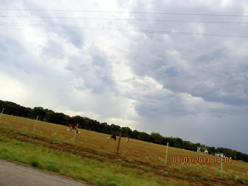
*Riding the country roads looking for RAIN:

This road is just around the corner from me en route to town. You can see the rain in distance:


Maybe next time!
...this is brendasue signing off from Rainbow Creek. See You next time!
"Baldy" Bluejay gets his head feathers!

No comments:
Post a Comment
Hi Everybody! Please say hello and follow so I know you are here! Due to the inconsideration of people trying to put commercials on my blog comment area, I have restricted use of anonymous posts. Sorry that some hurt all.
My public email is katescabin@gmail.com No spammers or trolls