

Hi Everybody!!
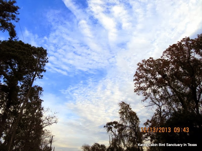
The morning of Friday the 13th was cold, very cold. How cold was it? So cold the whole sky froze. By 9:30am, the sky began to thaw as the Sun broke through the cloud barrier. The following pics are the weird cloud formations I was able to catch in the camera. The complete photostudy is located at the link below in my G+Photos. From Wikipedia, I have shared info on cirrus clouds.
Enjoy the view!


link to photostudy in G+Album:
https://plus.google.com/u/0/photos/117645114459863049265/albums/5957616574866911713


by: G+ Auto Backup!


https://en.wikipedia.org/wiki/Cirrus_cloud
Cirrus cloud
From Wikipedia, the free encyclopedia
Cirrus (cloud classification symbol: Ci) is a genus of atmospheric cloudgenerally characterized by thin, wispy strands, giving the type its name from the Latin word cirrus meaning a ringlet or curling lock of hair.[1][2] The strands of cloud sometimes appear in tufts of a distinctive form referred to by the common name of "mares' tails".[3]
Cirrus generally appears white or light gray in color. It forms when water vapor undergoes deposition at altitudes above 5,000 m (16,500 ft) in temperate regions and above 6,100 m (20,000 ft) in tropical regions. It also forms from the outflow of tropical cyclones or the anvils of cumulonimbus cloud. Since cirrus cloud arrives in advance of the frontal system or tropical cyclone, it indicates that weather conditions may soon deteriorate. While it indicates the arrival of precipitation (rain), cirrus cloud per se produces onlyfall streaks (falling ice crystals that evaporate before landing on the ground).

| Description |
Several types of Cirrus clouds.
|
| Date | |
| Source | Own work of user PiccoloNamek at the English language Wikipedia |
| Author | PiccoloNamek |
| Other versions |
Black and white versions File:CirrusField02.jpg and File:CirrusField.jpg
|
Jet stream-powered cirrus can grow long enough to stretch across continents, but it remains only a few kilometers deep.[4] When visible light interacts with the ice crystals in cirrus cloud, it producesoptical phenomena such as sun dogs and haloes. Cirrus is known to raise the temperature of the air beneath the main cloud layer by an average of 10 °C (18 °F). When the individual filaments become so extensive that they are virtually indistinguishable from one another, they form a sheet of high cloud called cirrostratus. Convection at high altitudes can produce another high based genus called cirrocumulus, a pattern of small cloud tufts that contain droplets of supercooled water.
Cirrus clouds form on other planets, including Mars, Jupiter, Saturn, Uranus, and possibly Neptune. They have even been seen onTitan, one of Saturn's moons. Some of these extraterrestrial cirrus clouds are composed of ammonia or methane ice rather than water ice. The term cirrus is also used for certain interstellar clouds composed of sub-micrometer sized dust grains.
Description[edit]

Cirrus cloud ranges in thickness from 100 m (330 ft) to 8,000 m (26,000 ft), with an average thickness of 1,500 m (4,900 ft). There are, on average, 30 ice crystals perliter (96 ice crystals per gallon), but this ranges from one ice crystal per 10,000 liters (3.7 ice crystals per 10,000 gallons) to 10,000 ice crystals per liter (37,000 ice crystals per gallon), a difference of eight orders of magnitude. The length of each of these ice crystals is usually 0.25 millimeters long,[5] but they range from as short as 0.01 millimeters or as long as several millimeters.[6] The ice crystals in contrailsare much smaller than those in naturally-occurring cirrus cloud, as they are around 0.001 millimeters to 0.1 millimeters in length.[7] Cirrus can vary in temperature from −20 °C (−4 °F) to −30 °C (−22 °F).[6]
The ice crystals in cirrus cloud have different shapes in addition to different sizes. Some shapes include solid columns, hollow columns, plates, rosettes, and conglomerations of the various other types. The shape of the ice crystals is determined by the air temperature, atmospheric pressure, and ice supersaturation. Cirrus in temperate regions typically have the shapes segregated by type: the columns and plates tend to be at the top of the cloud, whereas the rosettes and conglomerations tend to be near the base.[6] In the northern Arctic region, cirrus tend to be composed of only the columns, plates, and conglomerations, and these crystals tend to be at least four times larger than the minimum size. In Antarctica, cirrus are usually composed of only the columns, and these columns are much longer than normal.[6]
Scientists have studied the characteristics of cirrus using several different methods. One,Light Detection and Ranging (LiDAR), gives highly accurate information on the cloud's altitude, length, and width. Balloon-carried hygrometers give information on the humidity of the cirrus cloud, but are not accurate enough to measure the depth of the cloud. Radar units give information on the altitudes and thicknesses of cirrus cloud.[8] Another data source is satellite measurements from the Stratospheric Aerosol and Gas Experiment (SAGE) program. These satellites measure where infrared radiation is absorbed in the atmosphere, and if it is absorbed at cirrus altitudes, it is assumed that there is cirrus cloud in that location.[9] The United States National Aeronautics and Space Administration's (NASA)MODerate resolution Imaging Spectroradiometer (MODIS) also gives information on the cirrus cloud cover by measuring reflected infrared radiation of various specific frequencies during the day. During the night, it determines cirrus cover by detecting the Earth's infrared emissions. The cloud reflects this radiation back to the ground, thus enabling satellites to see the "shadow" it casts into space.[10] Visual observations from aircraft or the ground provide additional information about cirrus cloud.[9]Contrails[edit]
Contrails are a manmade type of cirrus cloud formed when water vapor from the exhaust of a jet engine condenses on particles, which come from either the surrounding air or the exhaust itself, and freezes, leaving behind a visible trail. The exhaust can also trigger the formation of cirrus by providing ice nuclei when there is an insufficient naturally-occurring supply in the atmosphere.[7]One of the environmental impacts of aviation is that persistent contrails can form into large mats of cirrus,[21] and increased air traffic has been implicated as one possible cause of the increasing frequency and amount of cirrus cloud in Earth's atmosphere.[21][22]
Effects on climate[edit]
Cirrus clouds cover up to 25% of the Earth and have a net heating effect.[28] When they are thin and translucent, the clouds efficiently absorb outgoing infrared radiation while only marginally reflecting the incoming sunlight.[29] When cirrus clouds are 100 m (330 ft) thick, they reflect only around 9% of the incoming sunlight, but they prevent almost 50% of the outgoing infrared radiation from escaping, thus raising the temperature of the atmosphere beneath the clouds by an average of 10 °C (18 °F)[30]—a process known as the greenhouse effect.[31] Averaged worldwide, cloud formation results in a temperature loss of 5 °C (9 °F) at the earth's surface, mainly the result of stratocumulus clouds.[32]

As a result of their warming effects when relatively thin, cirrus clouds have been implicated as a potential partial cause of global warming.[29] Scientists have speculated that global warming could cause high thin cloud cover to increase, thereby increasing temperatures and humidity. This, in turn, would increase the cirrus cloud cover, effectively creating a positive feedback circuit. A prediction of this hypothesis is that the cirrus would move higher as the temperatures rose, increasing the volume of air underneath the clouds and the amount of infrared radiation reflected back down to earth.[7] In addition, the hypothesis suggests that the increase in temperature would tend to increase the size of the ice crystals in the cirrus cloud, possibly causing the reflection of solar radiation and the reflection of the Earth's infrared radiation to balance out.[7][32]
A similar hypothesis put forth by Richard Lindzen is the iris hypothesis in which an increase in tropical sea surface temperatures results in less cirrus clouds and thus more infrared radiation emitted to space.[33]
Cirrocumulus[edit]

Main article: Cirrocumulus cloud
Cirrocumulus clouds form in sheets or patches[42] and do not cast shadows. They commonly appear in regular, rippling patterns[40] or in rows of clouds with clear areas between.[2] Cirrocumulus are, like other members of the cumuliform category, formed via convective processes.[43]Significant growth of these patches indicates high-altitude instability and can signal the approach of poorer weather.[44][45] The ice crystals in the bottoms of cirrocumulus clouds tend to be in the form of hexagonal cylinders. They are not solid, but instead tend to have stepped funnels coming in from the ends. Towards the top of the cloud, these crystals have a tendency to clump together.[46] These clouds do not last long, and they tend to change into cirrus because as the water vapor continues to deposit on the ice crystals, they eventually begin to fall, destroying the upward convection. The cloud then dissipates into cirrus.[47]Cirrocumulus clouds come in four species: stratiformis, lenticularis, castellanus, and floccus.[44] They are iridescent when the constituent supercooled water droplets are all about the same size.[45]


Panorama by Awesome AutoBackup

Fat Sissy is rolling us out of here!


...this is brendasue signing off from Rainbow Creek. See You next time. Below is the misting rain that settled in all night!


O+O
No comments:
Post a Comment
Hi Everybody! Please say hello and follow so I know you are here! Due to the inconsideration of people trying to put commercials on my blog comment area, I have restricted use of anonymous posts. Sorry that some hurt all.
My public email is katescabin@gmail.com No spammers or trolls