
Reported Quakes of today:
| MAG | UTC DATE-TIME y/m/d h:m:s | LAT deg | LON deg | DEPTH km | Region | |
|---|---|---|---|---|---|---|
| MAP | 2.5 | 2012/07/29 04:19:58 | 61.895 | -151.000 | 74.6 | SOUTHERN ALASKA |
| MAP | 4.5 | 2012/07/29 03:27:50 | 6.189 | 125.708 | 118.6 | MINDANAO, PHILIPPINES |
| MAP | 4.9 | 2012/07/29 03:04:43 | 7.933 | 126.635 | 86.5 | MINDANAO, PHILIPPINES |
| MAP | 5.7 | 2012/07/29 02:21:12 | 23.010 | 94.328 | 68.4 | MYANMAR |
| MAP | 2.6 | 2012/07/29 02:20:57 | 19.956 | -155.916 | 7.4 | ISLAND OF HAWAII, HAWAII |
| MAP | 3.2 | 2012/07/29 02:18:56 | 18.979 | -65.188 | 38.0 | PUERTO RICO REGION |
| MAP | 3.2 | 2012/07/29 00:26:48 | 18.924 | -65.219 | 6.0 | PUERTO RICO REGION |
| MAP | 3.1 | 2012/07/29 00:06:05 | 18.968 | -65.242 | 12.0 | PUERTO RICO REGION |
From Saturday morning news:
New Strong Earthquake Saturday:
6.6 Mwb - NEW IRELAND REGION, P.N.G.
| Magnitude | 6.6 Mwb |
| Date-Time |
|
| Location | 4.733S 153.173E |
| Depth | 66 km |
| Distances |
|
| Location Uncertainty | Horizontal: 14.7 km; Vertical 11.4 km |
| Parameters | Nph = 122; Dmin = 127.1 km; Rmss = 1.51 seconds; Gp = 19° M-type = Mwb; Version = 6 |
| Event ID | us b000bid9 |
For updates, maps, and technical information, see:
Event Page
or
USGS Earthquake Hazards Program
National Earthquake Information Center
U.S. Geological Survey
http://neic.usgs.gov/
Event Page
or
USGS Earthquake Hazards Program
National Earthquake Information Center
U.S. Geological Survey
http://neic.usgs.gov/
From Thursday morning news:
New Earthquake Thursday Morning:
News for Earthquake
 INAUTONEWS
- 6.7 magnitude earthquake hits off Mauritius
The Seattle Times - 42 minutes agoThe U.S. Geological Service said the earthquake early Thursday was centered about 250 miles north of the small Rodrigues island at a depth ...
cbs4qc.com - 22 minutes ago- San Jose Mercury News - 44 minutes ago
Hi Everybody! Please come in and look at this Information. There is serious activity going on with Earthquakes right now in real time. Warnings and alerts are out for now through the weekend and high risk for event situations are developing. This information is to advise you of your location risk by showing you the news on this subject.(Mostly coastlines). Please share this information with friends.
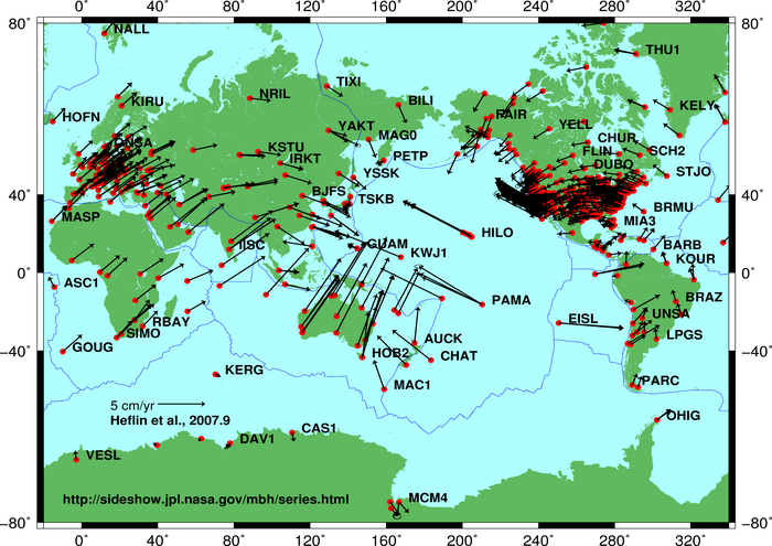
Global plate tectonic movement
http://en.wikipedia.org/wiki/File:Global_plate_motion_2008-04-17.jpg
Today, Yesterday and Day before Quake Report:
http://earthquake.usgs.gov/earthquakes/recenteqsww/Quakes/quakes_all.html
Latest Earthquakes in the World
| MAG | UTC DATE-TIME y/m/d h:m:s | LAT deg | LON deg | DEPTH km | Region | |
|---|---|---|---|---|---|---|
| MAP | 4.9 | 2012/07/26 02:38:58 | -31.427 | -178.975 | 34.2 | KERMADEC ISLANDS REGION |
| MAP | 2.5 | 2012/07/26 01:17:58 | 60.033 | -152.174 | 74.6 | SOUTHERN ALASKA |
| MAP | 5.3 | 2012/07/26 01:06:30 | 38.268 | 73.988 | 116.3 | TAJIKISTAN |
| MAG | UTC DATE-TIME y/m/d h:m:s | LAT deg | LON deg | DEPTH km | Region | |
|---|---|---|---|---|---|---|
| MAP | 4.3 | 2012/07/25 22:24:18 | 44.233 | -128.961 | 10.4 | OFF THE COAST OF OREGON |
| MAP | 5.1 | 2012/07/25 21:43:28 | -9.681 | 159.671 | 18.9 | SOLOMON ISLANDS |
| MAP | 2.7 | 2012/07/25 21:11:35 | 41.042 | -117.671 | 0.0 | NEVADA |
| MAP | 2.5 | 2012/07/25 20:24:07 | 18.120 | -65.723 | 3.0 | PUERTO RICO REGION |
| MAP | 4.7 | 2012/07/25 20:00:18 | 36.383 | 142.442 | 43.7 | OFF THE EAST COAST OF HONSHU, JAPAN |
| MAP | 5.0 | 2012/07/25 19:01:37 | -19.398 | 167.770 | 38.1 | VANUATU REGION |
| MAP | 2.5 | 2012/07/25 18:08:40 | 48.469 | -114.445 | 10.1 | WESTERN MONTANA |
| MAP | 4.9 | 2012/07/25 17:20:12 | 30.988 | 130.363 | 142.0 | KYUSHU, JAPAN |
| MAP | 4.0 | 2012/07/25 14:51:39 | 58.977 | -139.730 | 25.0 | OFF THE COAST OF SOUTHEASTERN ALASKA |
| MAP | 4.7 | 2012/07/25 14:51:15 | 36.091 | 69.239 | 22.7 | HINDU KUSH REGION, AFGHANISTAN |
| MAP | 4.6 | 2012/07/25 13:44:18 | -7.712 | 127.026 | 232.1 | KEPULAUAN BARAT DAYA, INDONESIA |
| MAP | 4.8 | 2012/07/25 13:27:53 | 5.532 | 126.458 | 136.3 | MINDANAO, PHILIPPINES |
| MAP | 6.5 | 2012/07/25 11:20:28 | -9.721 | 159.730 | 22.9 | SOLOMON ISLANDS |
| MAP | 4.6 | 2012/07/25 11:09:36 | -20.141 | -177.695 | 487.4 | FIJI REGION |
| MAP | 3.7 | 2012/07/25 10:18:42 | 33.964 | -118.407 | 10.8 | GREATER LOS ANGELES AREA, CALIFORNIA |
| MAP | 4.5 | 2012/07/25 10:09:53 | 5.600 | 127.070 | 114.5 | PHILIPPINE ISLANDS REGION |
| MAP | 4.7 | 2012/07/25 08:39:36 | 11.709 | 125.494 | 69.0 | SAMAR, PHILIPPINES |
| MAP | 3.0 | 2012/07/25 08:23:20 | 44.484 | -114.519 | 10.3 | SOUTHERN IDAHO |
| MAP | 4.9 | 2012/07/25 06:13:04 | 1.941 | 89.704 | 10.0 | NORTH INDIAN OCEAN |
| MAP | 4.6 | 2012/07/25 06:01:15 | -28.043 | -66.574 | 167.1 | CATAMARCA, ARGENTINA |
| MAP | 2.9 | 2012/07/25 04:07:18 | 38.838 | -122.785 | 2.6 | NORTHERN CALIFORNIA |
| MAP | 2.6 | 2012/07/25 02:45:19 | 60.858 | -149.425 | 19.9 | KENAI PENINSULA, ALASKA |
| MAP | 2.7 | 2012/07/25 02:34:18 | 51.079 | 179.135 | 15.7 | RAT ISLANDS, ALEUTIAN ISLANDS, ALASKA |
| MAP | 6.4 | 2012/07/25 00:27:45 | 2.657 | 96.126 | 22.0 | SIMEULUE, INDONESIA |
Space Weather and Earthquake Predictions:
Just Push Play
Just Push Play
News for earthquakes in july 2012
INAUTONEWS- Magnitude-3.8 earthquake jolts Southern California
Huffington Post - 17 minutes agoJuly 25, 2012 08:49 AM EST | Associated Press AP ... Seismologist say a mild earthquake widely felt throughout Southern California was centered along the ...
- Chicago Sun-Times - 11 hours ago
- Boxscore News - 1 day ago
http://latimesblogs.latimes.com/lanow/2012/07/earthquake-30-quake-strikes-near-the-geysers-33qm7k.html
L.A. NOW
SOUTHERN CALIFORNIA -- THIS JUST IN
Earthquake: 3.0 quake strikes near The Geysers

A shallow magnitude 3.0 earthquake was reported Tuesday evening three miles from The Geysers , according to the U.S. Geological Survey. The temblor occurred at 9:07 p.m. Pacific time at a depth of 1.2 miles.
According to the USGS, the epicenter was three miles from Cobb, seven miles from Anderson Springs, 27 miles from Santa Rosa and 74 miles from Sacramento.
In the last 10 days, there have been no earthquakes of magnitude 3.0 or greater centered nearby.
Read more about California earthquakes on L.A. Now.
-- Ken Schwencke
6.6 Mw - SIMEULUE, INDONESIA
| Magnitude | 6.6 Mw |
| Date-Time |
|
| Location | 2.654N 96.191E |
| Depth | 45 km |
| Distances |
|
| Location Uncertainty | Horizontal: 15.0 km; Vertical 10.9 km |
| Parameters | Nph = 77; Dmin = 214.8 km; Rmss = 1.04 seconds; Gp = 86° M-type = Mw; Version = 8 |
| Event ID | US b000bfha |
For updates, maps, and technical information, see:
Event Page
or
USGS Earthquake Hazards Program
National Earthquake Information Center
U.S. Geological Survey
http://neic.usgs.gov/
Event Page
or
USGS Earthquake Hazards Program
National Earthquake Information Center
U.S. Geological Survey
http://neic.usgs.gov/
6.5 Mw - SOLOMON ISLANDS
| Magnitude | 6.5 Mw |
| Date-Time |
|
| Location | 9.721S 159.730E |
| Depth | 22 km |
| Distances |
|
| Location Uncertainty | Horizontal: 15.8 km; Vertical 7.2 km |
| Parameters | Nph = 93; Dmin = 39.0 km; Rmss = 0.91 seconds; Gp = 50° M-type = Mw; Version = 7 |
| Event ID | US b000bfq0 |
For updates, maps, and technical information, see:
Event Page
or
USGS Earthquake Hazards Program
National Earthquake Information Center
U.S. Geological Survey
http://neic.usgs.gov/
Event Page
or
USGS Earthquake Hazards Program
National Earthquake Information Center
U.S. Geological Survey
http://neic.usgs.gov/
Here is a Link to check on EarthQuakes:
Real-time Earthquake Map
Solar Activity-Just Push Play
+++++++++++++++++++++++++
Feature Presentation: Last Year's 9.0-
March 11, 2011 Japan Earthquake,
10,000 People Died 20,000 People Missing; half a million displaced.
What Happened. How it Happened. Future Risks. Four 10 minute videos in this set featuring Dr. Iain Stewart. This was the most photographed, monitored and researched major earthquake in History. Professor Stewart explains everything so well. I reccommend everyone watch these Earthquake Vids-
Just Push Play
Just Push Play
Just Push Play
Just Push Play
I hope You find that this Post was informative and gives You warning to prepare if You are in the High Risk Environments. I am very worried about all my friends on All Coasts around the World.
...this is brendasue signing off from Rainbow Creek
Of course, one more great Prayer for Everyone in the World and Especially Remembering Our Sisters & Brothers in Japan, and all my friends. I Love You.
Just Push Play
O+O
No comments:
Post a Comment
Hi Everybody! Please say hello and follow so I know you are here! Due to the inconsideration of people trying to put commercials on my blog comment area, I have restricted use of anonymous posts. Sorry that some hurt all.
My public email is katescabin@gmail.com No spammers or trolls