

The Report Continues.....Tonight You get a break from our Saintly Studies for an update on the Earthquake Activity in Alaska which is continuing since the big one on the 5th. We are taking a little video trip to Alaska to see it for ourselves. Upon consideration if 'anyone' would try to crack up the earth intentionally with an earthquake begs the question WHY? Maybe for the HUGE amount of Gold Hidden in Alaska? To make such a statement may seem naive and perhaps preposterous!
http://www.youtube.com/watch?v=zNwo1dxsW6c
http://en.wikipedia.org/wiki/Kodiak,_Alaska
Kodiak, Alaska
From Wikipedia, the free encyclopedia
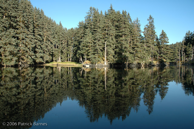
Kodiak (Russian: Кадьяк, tr. Kadʹyak) is one of 7 communities and the main city onKodiak Island, Kodiak Island Borough, in the U.S. state of Alaska. All commercial transportation between the entire island and the outside world goes through this city either via ferryboat or airline. The population was 6,130 as of the 2010 census.
Originally inhabited by Alutiiq natives for over 7000 years, the city was settled in the 18th century by the subjects of the Russian crown and became the capital of Russian Alaska. Harvesting of the area's sea otter pelts led to the near extinction of the animal in the following century and led to wars with and enslavement of the natives for over 150 years. As part of the Alaska Purchase by the United States in 1867, Kodiak became a commercial fishing center which continues to this day. A lesser economic influence includes tourism, mainly by those seeking outdoor adventure trips. Salmon, halibut, the unique Kodiak Bear, elk, Sitka Deer (black tail), and mountain goats invite hunting tourists as well as fishermen to the Kodiak Archipelago. The Alaska Department of Fish and Game maintains an office in the city and a website to help hunters and fishermen obtain the proper permits and learn about the laws specific to the Kodiak area. The city has four public elementary schools, a middle and high school, as well as a branch of the University of Alaska. An antenna farm at the summit of Pillar Mountain above the city historically provided communication with the outside world before fiber optic cable was run. Transportation to and from the island is provided by ferry service on the Alaska Marine Highway as well as local commercial airlines
Military installations
The United States Navy operates a small training base near the city called Naval Special Warfare Cold Weather Detachment Kodiak which trains United States Navy SEALs in cold weather survival and advanced tactics.[14]
The United States Coast Guard has a major presence in Kodiak, Alaska.
- USCG Air Station Kodiak
- USCGC Alex Haley (WMEC-39)
- USCGC Spar (WLB-206)
- USCGC Munro (WHEC-724)
- Aids to Navigation Team Kodiak
- Communication Station Kodiak
- North Pacific Regional Training Center (NPRTC)
- Marine Safety Detachment Kodiak
- Naval Engineering Support Unit (NESU) Detachment Kodiak
- Electronic Systems Support Unit Kodiak (ESU)
- Loran Station Kodiak
Kodiak
Alaska
http://www.youtube.com/watch?v=URCaWGqVq5Y
January 5, 2013
Large Earthquake/No Tsunami
M7.5 - 94km W of Craig, Alaska2013-01-05 08:58:19 UTC
Event Time
- 2013-01-05 08:58:19 UTC
- 2013-01-04 23:58:19 UTC-09:00 at epicenter
- 2013-01-05 02:58:19 UTC-06:00 system time
Location
55.368°N 134.621°W depth=9.8km (6.1mi)
Nearby Cities
- 94km (58mi) W of Craig, Alaska
- 300km (186mi) WNW of Prince Rupert, Canada
- 326km (203mi) S of Juneau, Alaska
- 397km (247mi) WNW of Terrace, Canada
- 596km (370mi) S of Whitehorse, Canada
Tectonic Summary
The January 5, 2013 M 7.5 earthquake off the west coast of southeastern Alaska occurred as a result of shallow strike-slip faulting on or near the plate boundary between the Pacific and North America plates. At the location of this earthquake, the Pacific plate is moving north-northwestward with respect to the North America plate at a velocity of appoximately 51 mm/yr.
This earthquake is likely associated with relative motion across the Queen Charlotte fault system offshore of Alaska and British Columbia, Canada, which forms the major expression of the Pacific:North America plate boundary in this region. The surrounding area of the plate boundary has hosted 8 earthquakes of magnitude 6 or greater over the past 40 years. In 1949, a M 8.1 strike-slip earthquake nucleated in the Pacific:North America plate boundary region approximately 200 km to the southeast of the January 5 event, and the causative fault ruptured close to, or into, the January 5 source region. In October of 2012, a M 7.8 earthquake occurred in the plate-boundary region approximately 330 km to the south east of the January 5 earthquake, and was associated with oblique-thrust faulting. The January 5, 2013 earthquake is related to that Haida Gwaii earthquake three months previously, and is an expression of deformation along the same plate boundary system.
This earthquake is likely associated with relative motion across the Queen Charlotte fault system offshore of Alaska and British Columbia, Canada, which forms the major expression of the Pacific:North America plate boundary in this region. The surrounding area of the plate boundary has hosted 8 earthquakes of magnitude 6 or greater over the past 40 years. In 1949, a M 8.1 strike-slip earthquake nucleated in the Pacific:North America plate boundary region approximately 200 km to the southeast of the January 5 event, and the causative fault ruptured close to, or into, the January 5 source region. In October of 2012, a M 7.8 earthquake occurred in the plate-boundary region approximately 330 km to the south east of the January 5 earthquake, and was associated with oblique-thrust faulting. The January 5, 2013 earthquake is related to that Haida Gwaii earthquake three months previously, and is an expression of deformation along the same plate boundary system.
The January 5 event broke a fault approximately 50 km in length, and slipped 7-8 m.
| 3.9 | 102km W of Craig, Alaska | 55.464°N | 134.761°W | 3.1 | |
| 4.7 | 115km W of Craig, Alaska | 55.334°N | 134.948°W | 10.0 | |
| 4.6 | 114km W of Craig, Alaska | 55.386°N | 134.944°W | 9.1 | |
| 4.0 | 116km S of Sitka, Alaska | 56.008°N | 135.454°W | 10.0 | |
| 2.5 | 98km WSW of Craig, Alaska | 55.235°N | 134.647°W | 20.0 | |
| 2.8 | 102km WSW of Craig, Alaska | 55.254°N | 134.714°W | 20.0 | |
| 3.0 | 136km W of Craig, Alaska | 55.625°N | 135.289°W | 20.0 | |
| 2.5 | 117km W of Craig, Alaska | 55.443°N | 135.002°W | 20.0 | |
| 2.5 | 130km W of Craig, Alaska | 55.677°N | 135.186°W | 20.0 | |
| 2.7 | 126km WNW of Craig, Alaska | 55.707°N | 135.108°W | 20.0 | |
| 2.6 | 110km W of Craig, Alaska | 55.383°N | 134.884°W | 20.0 | |
| 3.3 | 113km W of Craig, Alaska | 55.480°N | 134.943°W | 20.0 | |
| 2.6 | 92km W of Craig, Alaska | 55.352°N | 134.593°W | 20.0 |
http://earthquake.usgs.gov/earthquakes/eventpage/ak10635699#summary
Still Quaking 5 days Later
M2.5 - 63km ENE of Kodiak, Alaska2013-01-10 05:24:01 UTC
Tectonic Summary
Seismotectonics of the Aleutian Arc
The Aleutian arc extends approximately 3,000 km from the Gulf of Alaska in the east to the Kamchatka Peninsula in the west. It marks the region where the Pacific plate subducts into the mantle beneath the North America plate. This subduction is responsible for the generation of the Aleutian Islands and the deep offshore Aleutian Trench.
The curvature of the arc results in a westward transition of relative plate motion from trench-normal (i.e., compressional) in the east to trench-parallel (i.e., translational) in the west, accompanied by westward variations in seismic activity, volcanism, and overriding plate composition. The Aleutian arc is generally divided into three regions: the western, central, and eastern Aleutians. Relative to a fixed North America plate, the Pacific plate is moving northwest at a rate that increases from roughly 60 mm/yr at the arc's eastern edge to 76 mm/yr near its western terminus. The eastern Aleutian arc extends from the Alaskan Peninsula in the east to the Fox Islands in the west. Motion along this section of the arc is characterized by arc-perpendicular convergence and Pacific plate subduction beneath thick continental lithosphere. This region exhibits intense volcanic activity and has a history of megathrust earthquakes.
The central Aleutian arc extends from the Andreanof Islands in the east to the Rat Islands in the west. Here, motion is characterized by westward-increasing oblique convergence and Pacific plate subduction beneath thin oceanic lithosphere. Along this portion of the arc, the Wadati-Benioff zone is well defined to depths of approximately 200 km. Despite the obliquity of convergence, active volcanism and megathrust earthquakes are also present along this margin.
The western Aleutians, stretching from the western end of the Rat Islands in the east to the Commander Islands, Russia, in the west, is tectonically different from the central and eastern portions of the arc. The increasing component of transform motion between the Pacific and North America plates is evidenced by diminishing active volcanism; the last active volcano is located on Buldir Island, in the far western portion of the Rat Island chain. Additionally, this portion of the subduction zone has not hosted large earthquakes or megathrust events in recorded history. Instead, the largest earthquakes in this region are generally shallow, predominantly strike-slip events with magnitudes between M5-6. Deeper earthquakes do occur, albeit rather scarcely and with small magnitudes (M<4), down to approximately 50 km.
Most of the seismicity along the Aleutian arc results from thrust faulting that occurs along the interface between the Pacific and North America plates, extending from near the base of the trench to depths of 40 to 60 km. Slip along this interface is responsible for generating devastating earthquakes. Deformation also occurs within the subducting slab in the form of intermediate-depth earthquakes that can reach depths of 250 km. Normal faulting events occur in the outer rise region of the Aleutian arc resulting from the bending of the oceanic Pacific plate as it enters the Aleutian trench. Additionally, deformation of the overriding North America plate generates shallow crustal earthquakes.
The Aleutian arc is a seismically active region, evidenced by the many moderate to large earthquakes occurring each year. Since 1900, this region has hosted twelve large earthquakes (M>7.5) including the May 7, 1986 M8.0 Andreanof Islands, the June 10, 1996 M7.9 Andreanof Islands, and the November 17, 2003 M7.8 Rat Islands earthquakes. Six of these great earthquakes (M8.3 or larger) have occurred along the Aleutian arc that together have ruptured almost the entire shallow megathrust contact. The first of these major earthquakes occurred on August 17, 1906 near the island of Amchitka (M8.3) in the western Aleutian arc. However, unlike the other megathrust earthquakes along the arc, this event is thought to have been an intraplate event occurring in the shallow slab beneath the subduction zone interface.
The first megathrust event along the arc during the 20th century was the November 10, 1938 M8.6 Shumagin Island earthquake. This event ruptured an approximately 300 km long stretch of the arc from the southern end of Kodiak Island to the northern end of the Shumagin Islands and generated a small tsunami that was recorded as far south as Hawaii.
The April 1, 1946 M8.6 Unimak Island earthquake, located in the central Aleutian arc, was characterized by slow rupture followed by a devastating Pacific-wide tsunami that was observed as far south as the shores of Antarctica. Although damage from earthquake shaking was not severe locally, tsunami run-up heights were recorded as high as 42 m on Unimak Island and tsunami waves in Hilo, Hawaii also resulted in casualties. The slow rupture of this event has made it difficult to constrain the focal mechanism and depth of the earthquake, though it is thought to have been an interplate thrust earthquake.
The next megathrust earthquake occurred along the central portion of the Aleutian arc near the Andreanof Islands on March 9, 1957, with a magnitude of M8.6. The rupture length of this event was approximately 1200 km, making it the longest observed aftershock zone of all the historic Aleutian arc events. Although only limited seismic data from this event are still available, significant damage and tsunamis were observed on the islands of Adak and Unimak with tsunami heights of approximately 13 m.
The easternmost megathrust earthquake was the March 28, 1964 M9.2 Prince William Sound earthquake, currently the second largest recorded earthquake in the world. The event had a rupture length of roughly 700 km extending from Prince William Sound in the northeast to the southern end of Kodiak Island in the southwest. Extensive damage was recorded in Kenai, Moose Pass, and Kodiak but significant shaking was felt over a large region of Alaska, parts of western Yukon Territory, and British Columbia, Canada. Property damage was the largest in Anchorage, as a result of both the main shock shaking and the ensuing landslides. This megathrust earthquake also triggered a devastating tsunami that caused damage along the Gulf of Alaska, the West Coast of the United States, and in Hawaii.
The westernmost Aleutians megathrust earthquake followed a year later on February 4, 1965. This M8.7 Rat Islands earthquake was characterized by roughly 600 km of rupture. Although this event is quite large, damage was low owing to the region's remote and sparsely inhabited location. A relatively small tsunami was recorded throughout the Pacific Ocean with run-up heights up to 10.7 m on Shemya Island and flooding on Amchitka Island.
Although the Aleutian arc is highly active, seismicity is rather discontinuous, with two regions that have not experienced a large (M>8.0) earthquake in the past century: the Commander Islands in the western Aleutians and the Shumagin Islands in the east. Due to the dominantly transform motion along the western arc, there is potential that the Commander Islands will rupture in a moderate to large strike-slip earthquake in the future. The Shumagin Islands region may also have high potential for hosting a large rupture in the future, though it has been suggested that little strain is being accumulated along this section of the subduction zone, and thus associated hazards may be reduced.
East of the Aleutian arc along the Gulf of Alaska, crustal earthquakes occur as a result transmitted deformation and stress associated with the northwestward convergence of the Pacific plate that collides a block of oceanic and continental material into the North America plate. In 2002, the Denali Fault ruptured in a sequence of earthquakes that commenced with the October 23 M6.7 Nenana Mountain right-lateral strike-slip earthquake and culminated with the November 3, M7.9 Denali earthquake which started as a thrust earthquake along a then unrecognized fault and continued with a larger right-lateral strike-slip event along the Denali and Totschunda Faults.
Helpful Information for people in Alaska from USGS:
http://earthquake.usgs.gov/earthquakes/states/index.php?regionID=3
Alaska Earthquake Information
Historic Information
Institutions
- Alaska Department of Natural Resources
- Alaska Division of Geological & Geophysical Surveys
- Alaska Division of Homeland Security and Emergency Management
- Alaska Earthquake Information Center
- Alaska Volcano Observatory
Maps
http://www.aeic.alaska.edu/


 Earthquake in the Kodiak Island region of Alaska
Visit this Link for updated Information
http://www.aeic.alaska.edu/Seis/recent/macsub/quakes/2013010_evid10635699/evid10635699.htmlVid of the big quake on 5th January:
http://en.wikipedia.org/wiki/1958_Lituya_Bay_megatsunami
1958 Lituya Bay megatsunami
From Wikipedia, the free encyclopedia
The 1958 Lituya Bay megatsunami occurred on July 9, 1958, when an earthquaketriggered a landslide that caused 30 million cubic metres of rock and ice to fall into the narrow inlet of Lituya Bay, Alaska. The sudden displacement of water resulted in a wave hundreds of metres high, that washed over trees and was ultimately measured as washing 524 metres (1,720 feet) up the opposite slope of the inlet, 143 metres (470 feet) taller than the roof of the Empire State Building. This is the highest recordedmegatsunami and the largest known in modern times. The event forced a re-evaluation of large wave events, and recognition of impact and landslide events as a previously unknown cause of very large waves.
 | |
| Date | July 9, 1958 |
|---|---|
| Magnitude | 8.3 Mw |
| Depth | 60 km |
| Epicenter | 58.340°N 136.520°W[1] |
| Countries or regions | United States (Lituya Bay) |
| Tsunami | Yes |
| Casualties | 5[2] |

http://www.youtube.com/watch?v=yN6EgMMrhdI
http://www.youtube.com/watch?v=C6PYeqemwzY
http://www.youtube.com/watch?v=aJH1JQWrARQ
Of Course, another great performance
http://www.youtube.com/watch?v=Xu-FiZeI4K4
Breaking News:
O+O
No comments:
Post a Comment
Hi Everybody! Please say hello and follow so I know you are here! Due to the inconsideration of people trying to put commercials on my blog comment area, I have restricted use of anonymous posts. Sorry that some hurt all.
My public email is katescabin@gmail.com No spammers or trolls