Hi Everybody!!

Hi Everybody!!
Welcome to my Hometown!!

Wednesday, January 16, 2013

Surprise! We Are Going to New York City to See What's Up! (A New York City Photo Blog)


Hi Everybody:
Surprise Field Trip: We are going to New York City, New York!!! I have never been to New York, so I thought we better go have a look for ourselves and see exactly what is going on! 
(For sure, something
 is always going on!!)
Anyway, I collected some New York Vids from the Google You Tube Library and I found a few maps and images in the Goggle Index under New York City Images to share with you here. Also, for the curious among us------------------
the Batman Map of Gotham City. Is it New York City? What do You think?
What better way to end a great night other than with a Stairway to Heaven!

NEW YORK (LIZA MINELLI)


http://www.youtube.com/watch?v=0LWlClxTwsw


New York Circle Isle boat ride


http://www.youtube.com/watch?v=qD55n84zMYE


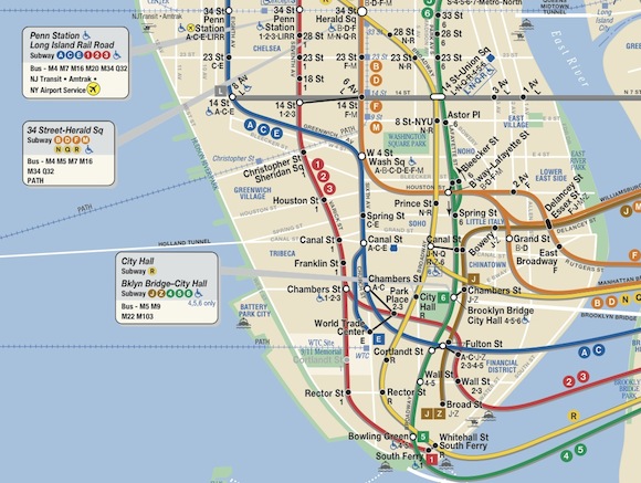
Quietly, a new old look for the subway map

By 
http://secondavenuesagas.com/2011/10/05/quietly-a-new-old-look-for-the-subway-map/

http://dompascual.com/new-york-subway-map-mta/


http://www.picstopin.com/2034/manhattan-bridge-map-new-york-city-at/http:%7C%7Cwww*museumplanet*com%7Cimage%7Cnyc%7Cmb%7Cmb001*jpg/


http://www.mynewplace.com/neighborhood/two-bridges-apartments-for-rent-new-york-ny

http://www.youtube.com/watch?v=akt5TMyMNe8


New York City's Subways, Tunnels, Bridges Recover From Hurricane Sandy


http://www.youtube.com/watch?v=nwKQF-_xtvo

http://www.youtube.com/watch?v=WKNj_Tf8dGc

Bridges of NYC From the Water


http://www.fhwa.dot.gov/everydaycounts/technology/bridges/pbeswebinartraining/s2_m4.cfm

Prefabricated Bridge Elements and Systems

by
Mary Lou Ralls, P.E., Principal
Ralls Newman, LLC
(formerly Texas State Bridge Engineer)

Slide 2. Learning Outcomes

  • Identify examples of ABC/PBES replacement projects that achieved onsite construction time and cost savings, and locate project contacts
  • Describe combinations of PBES and contracting strategies that achieved accelerated onsite construction timelines at lower costs
  • Explain why comparison of ABC costs and conventional construction costs may not be appropriate
  • Explain why moving to ABC/PBES as a standard practice will achieve cost savings
Speaker Notes:
Upon completion of this module, participants will be able to:
  • Identify examples of replacement projects that used prefabricated bridge elements for accelerated bridge construction and achieved onsite construction time and cost savings; you’ll also know where to go for the project contacts
  • Describe combinations of prefabricated bridge elements and contracting strategies that achieved accelerated onsite construction timelines at lower costs
  • Explain why ABC cost and conventional construction cost comparisons may not be appropriate, and
  • Explain why moving to prefabricated bridges as a standard practice will achieve cost savings

There is Another Sandy Hook Location besides the school-out in the water.

There is a Red Hook also

And, a Paulus Hook

GOOGLE THEM IN SEARCH BOX!!

http://www.state.nj.us/njoem/citizen/cert.html

Earthquakes May Endanger New York More Than Thought, Says Study

Indian Point Nuclear Power Plant Seen As Particular Risk

2008-08-21
http://www.earth.columbia.edu/articles/view/2235
A study by a group of prominent seismologists suggests that a pattern of subtle but active faults makes the risk of earthquakes to the New York City area substantially greater than formerly believed. Among other things, they say that the controversial Indian Point nuclear power plants, 24 miles north of the city, sit astride the previously unidentified intersection of two active seismic zones.

New York City and a few other parts of the eastern United States stand out on US Geological Survey seismic hazard maps
Courtesy USGS Earthquake Hazards Program

The authors compiled a catalog of all 383 known earthquakes from 1677 to 2007 in a 15,000-square-mile area around New York City. Coauthor John Armbruster estimated sizes and locations of dozens of events before 1930 by combing newspaper accounts and other records. The researchers say magnitude 5 quakes—strong enough to cause damage--occurred in 1737, 1783 and 1884. There was little settlement around to be hurt by the first two quakes, whose locations are vague due to a lack of good accounts; but the last, thought to be centered under the seabed somewhere between Brooklyn and Sandy Hook, toppled chimneys across the city and New Jersey, and panicked bathers at Coney Island. Based on this, the researchers say such quakes should be routinely expected, on average, about every 100 years. “Today, with so many more buildings and people, a magnitude 5 centered below the city would be extremely attention-getting,” said Armbruster. “We’d see billions in damage, with some brick buildings falling. People would probably be killed.”

The researchers say that frequent small quakes occur in predictable ratios to larger ones, and so can be used to project a rough time scale for damaging events. Based on the lengths of the faults, the detected tremors, and calculations of how stresses build in the crust, the researchers say that magnitude 6 quakes, or even 7—respectively 10 and 100 times bigger than magnitude 5--are quite possible on the active faults they describe. They calculate that magnitude 6 quakes take place in the area about every 670 years, and sevens, every 3,400 years. The corresponding probabilities of occurrence in any 50-year period would be 7% and 1.5%. After less specific hints of these possibilities appeared in previous research, a 2003 analysis byThe New York City Area Consortium for Earthquake Loss Mitigation put the cost of quakes this size in the metro New York area at $39 billion to $197 billion. A separate2001 analysis for northern New Jersey’s Bergen County estimates that a magnitude 7 would destroy 14,000 buildings and damage 180,000 in that area alone. The researchers point out that no one knows when the last such events occurred, and say no one can predict when they next might come

The researchers found concrete evidence for one significant previously unknown structure: an active seismic zone running at least 25 miles from Stamford, Conn., to the Hudson Valley town of Peekskill, N.Y., where it passes less than a mile north of the Indian Point nuclear power plant. The Stamford-Peekskill line stands out sharply on the researchers’ earthquake map, with small events clustered along its length, and to its immediate southwest. Just to the north, there are no quakes, indicating that it represents some kind of underground boundary. It is parallel to the other faults beginning at 125th Street, so the researchers believe it is a fault in the same family. Like the others, they say it is probably capable of producing at least a magnitude 6 quake. Furthermore, a mile or so on, it intersects the Ramapo seismic zone.

“This is a landmark study in many ways,” said Lerner-Lam. “It gives us the best possible evidence that we have an earthquake hazard here that should be a factor in any planning decision. It crystallizes the argument that this hazard is not random. There is a structure to the location and timing of the earthquakes. This enables us to contemplate risk in an entirely different way. And since we are able to do that, we should be required to do that.”

Existing U.S. Geological Survey seismic hazard maps show New York City as facing more hazard than many other eastern U.S. areas. Three areas are somewhat more active—northernmost New York State, New Hampshire and South Carolina—but they have much lower populations and fewer structures. The wider forces at work include pressure exerted from continuing expansion of the mid-Atlantic Ridge thousands of miles to the east; slow westward migration of the North American continent; and the area’s intricate labyrinth of old faults, sutures and zones of weakness caused by past collisions and rifting.
Due to New York’s past history, population density and fragile, interdependent infrastructure, a 2001 analysis by the Federal Emergency Management Agency ranks it the 11th most at-risk U.S. city for earthquake damage. Among those ahead: Los Angeles, San Francisco, Seattle and Portland. Behind: Salt Lake City, Sacramento, Anchorage.
SEE THE LINK FOR COMPLETE ARTICLE

 Next A Look at the Batman Map 

of Gotham City/New York City?


URGENT::Gotham Map Investigation


http://www.youtube.com/watch?v=QZd0WiivbCU


Dark Knight - N-A-U - MAP 21 Agenda ( PRT 1 )


http://www.youtube.com/watch?v=GURK9vCePeY

Dark Knight - N-A-U - MAP 21 Agenda ( PART 2 )


http://www.youtube.com/watch?v=yMNM4QLzM_c

http://www.youtube.com/watch?v=YCZuZC1Cu4s
...this is brendasue signing off from Rainbow Creek.  See You next time!!!!!
Of Course, One More Great Performance
http://www.youtube.com/watch?v=JK_DOJa99oo

O+O

No comments:

Post a Comment

Hi Everybody! Please say hello and follow so I know you are here! Due to the inconsideration of people trying to put commercials on my blog comment area, I have restricted use of anonymous posts. Sorry that some hurt all.
My public email is katescabin@gmail.com No spammers or trolls